A full course for beginners to biomes, covering in detail every biome of earth according to the LONS08 specification. Includes the full video for each biome, in addition to the full script, for reference, along with key diagrams, exclusive hi-resolution maps and charts not found anywhere else, and sample coursework questions to test your understanding.
It is recommended that you study the course in order, beginning with “Introduction” and follow the link through on each page to take you to the next.
When you look at pictures of the Earth from space, what’s the first thing that you see? A blue marble, as some have described it. A water world where oceans and swirls of white cloud dominate. But most of us will then have our attention drawn to the shapes imprinted on its surface – the continents. And they come in many colours. The white of Antarctica, the beige of the Sahara, the light green of grasslands and the darker shades of our planet’s forests in their many forms.
So many of these colours that give the world its look are the result of trillions of individual plants growing upon the surface. Which plants grow where is determined by many factors, with climate being most dominant factor. Desert and scrubland, savannah, prairie and steppe, tundra and taiga, woodland and rainforest. They are at the base of almost every food chain of every animal – the habitats that sustain all other lifeforms, and ourselves. Collectively, they are known as biomes – the living landscapes of Earth.
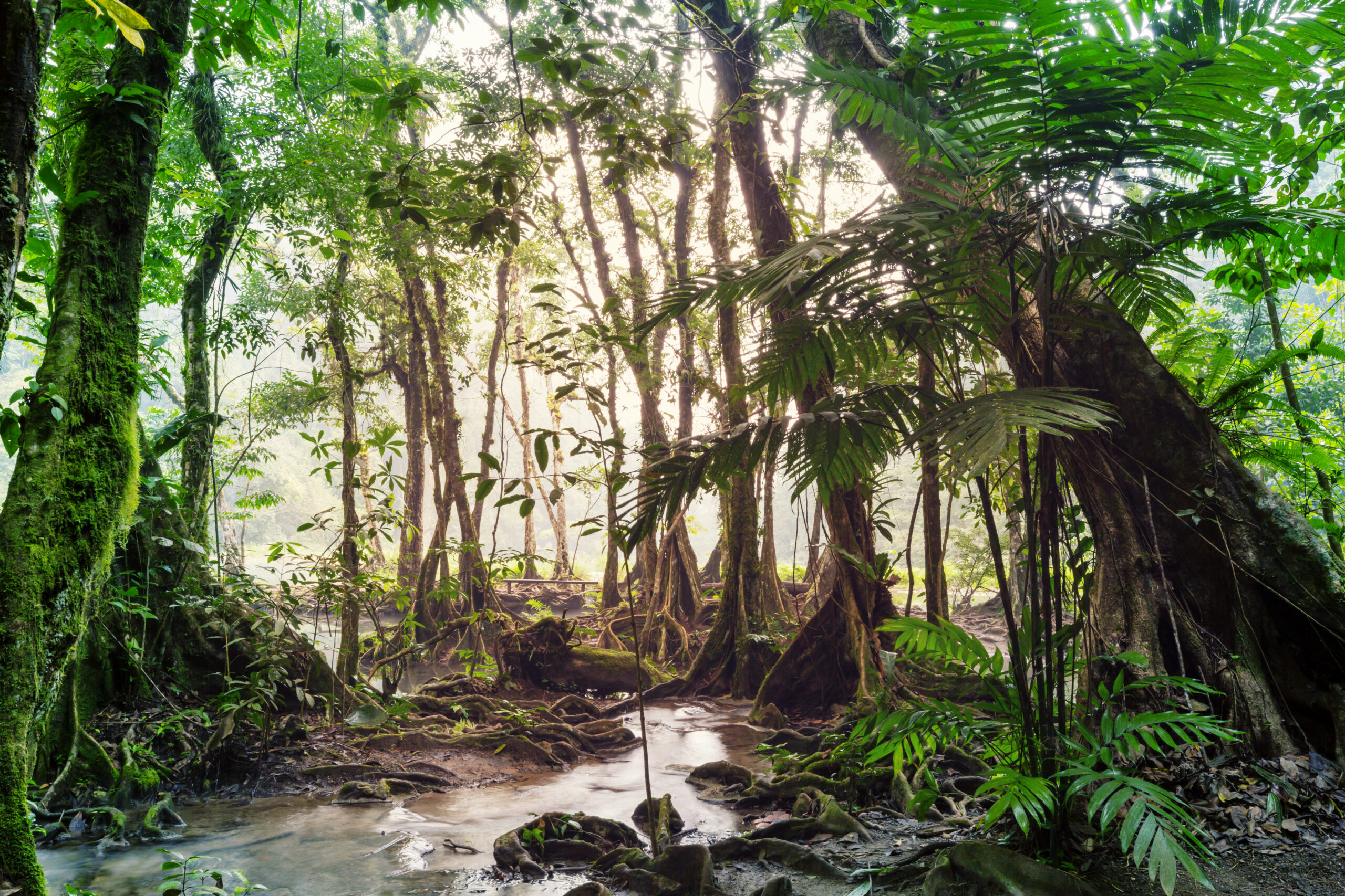
Tropical rainforest in French Guiana
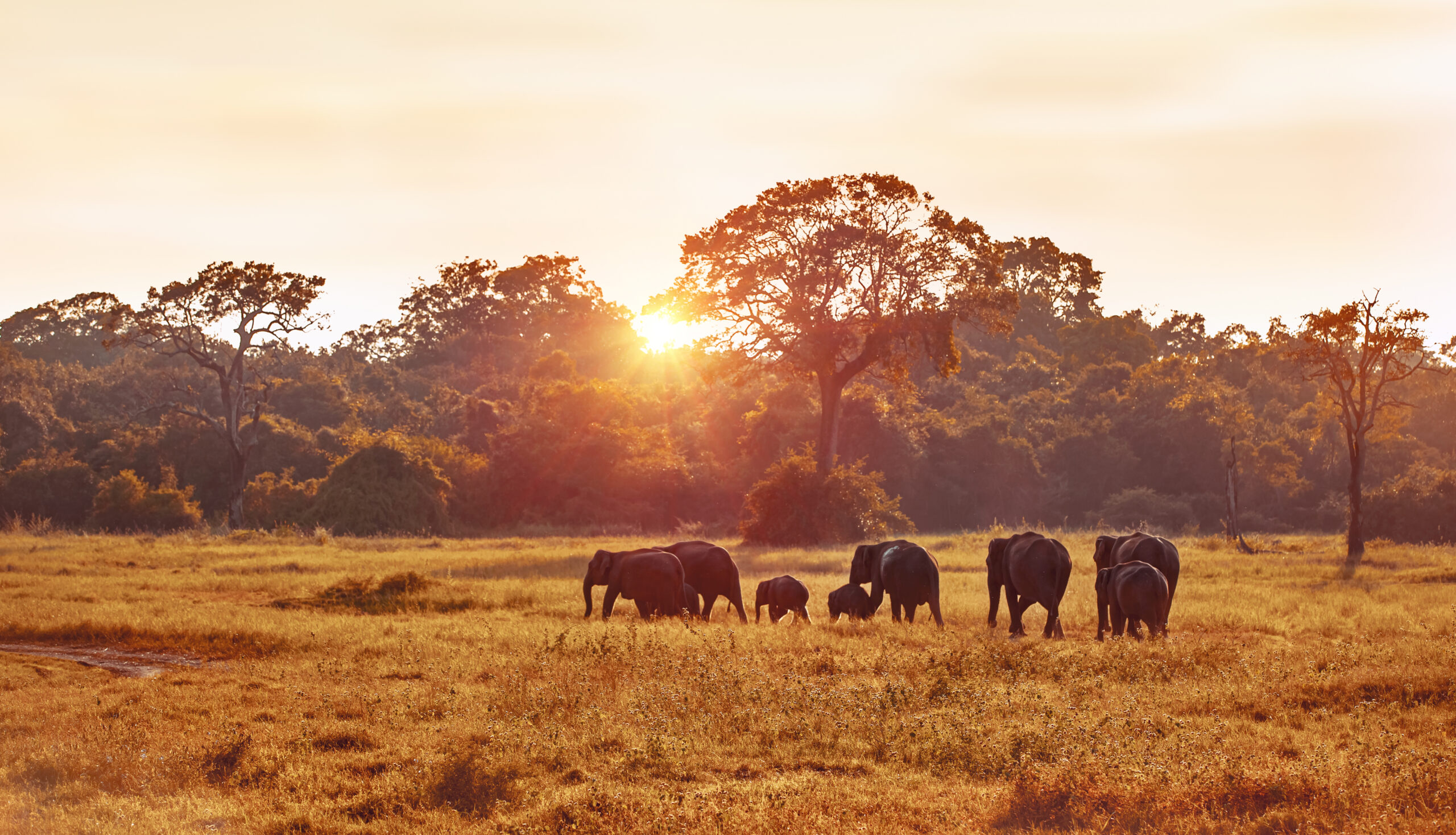
Savannah in Kenya
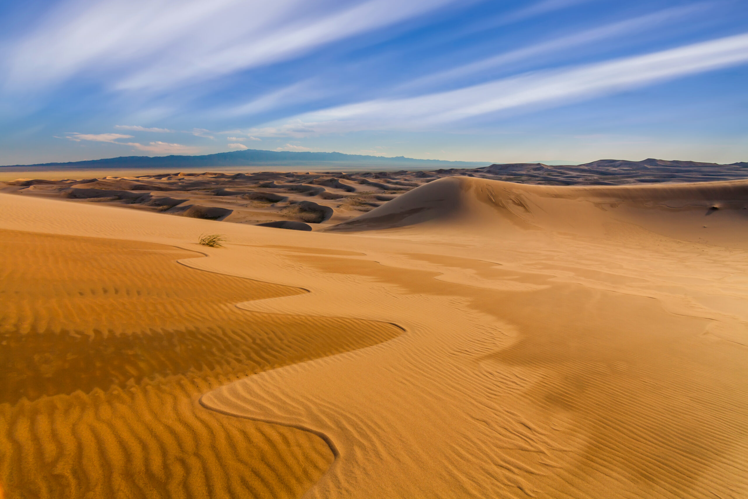
Semi-Arid desert in eastern California, USA
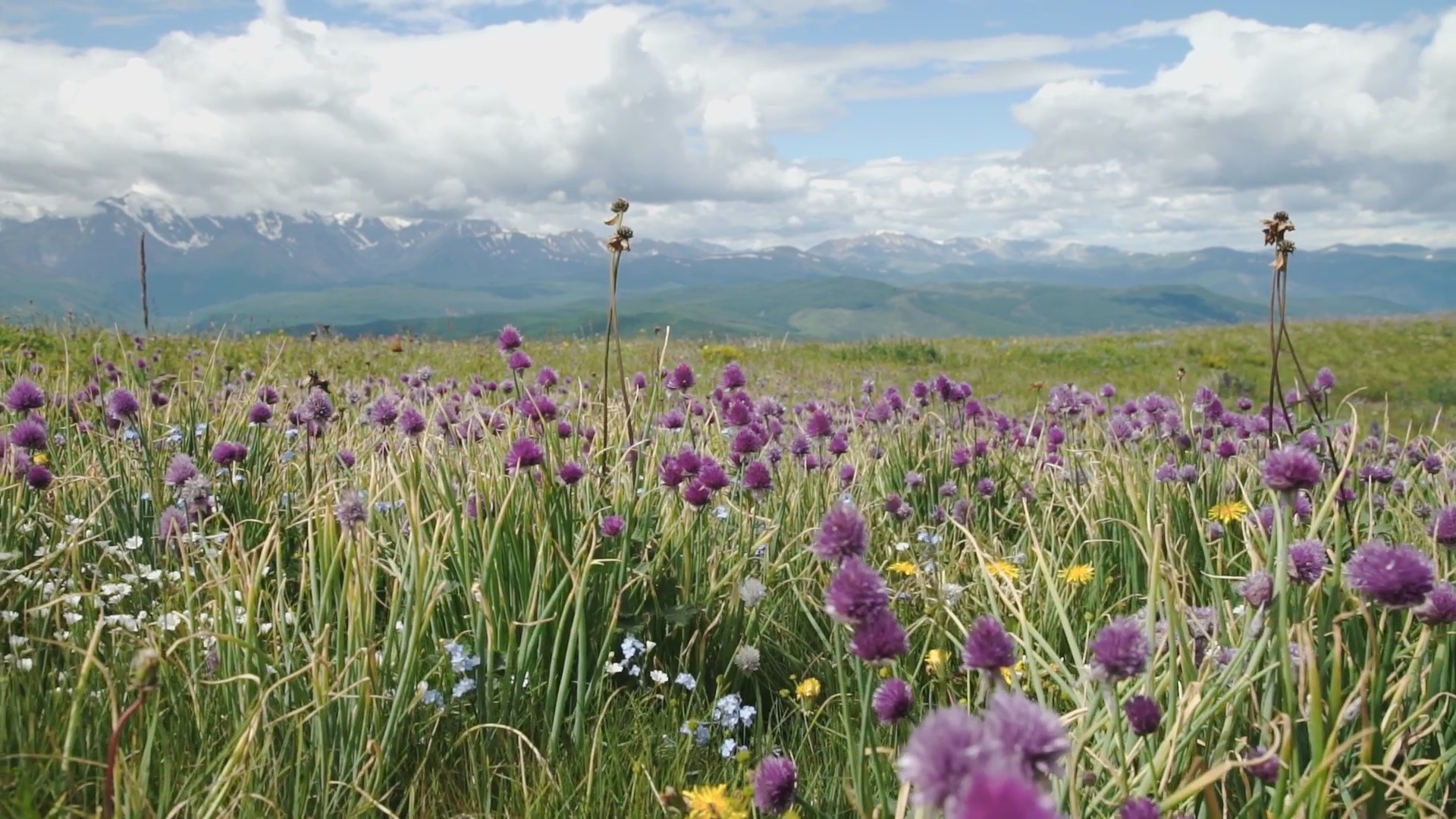
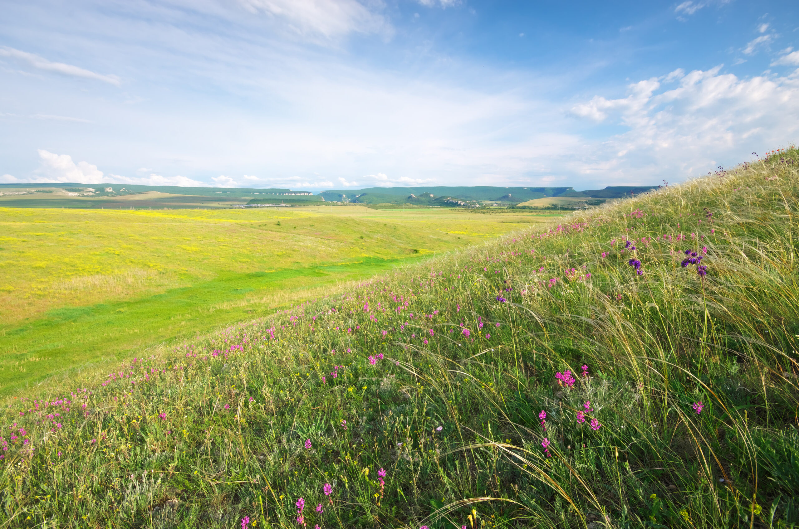
Steppe grassland in Mongolia
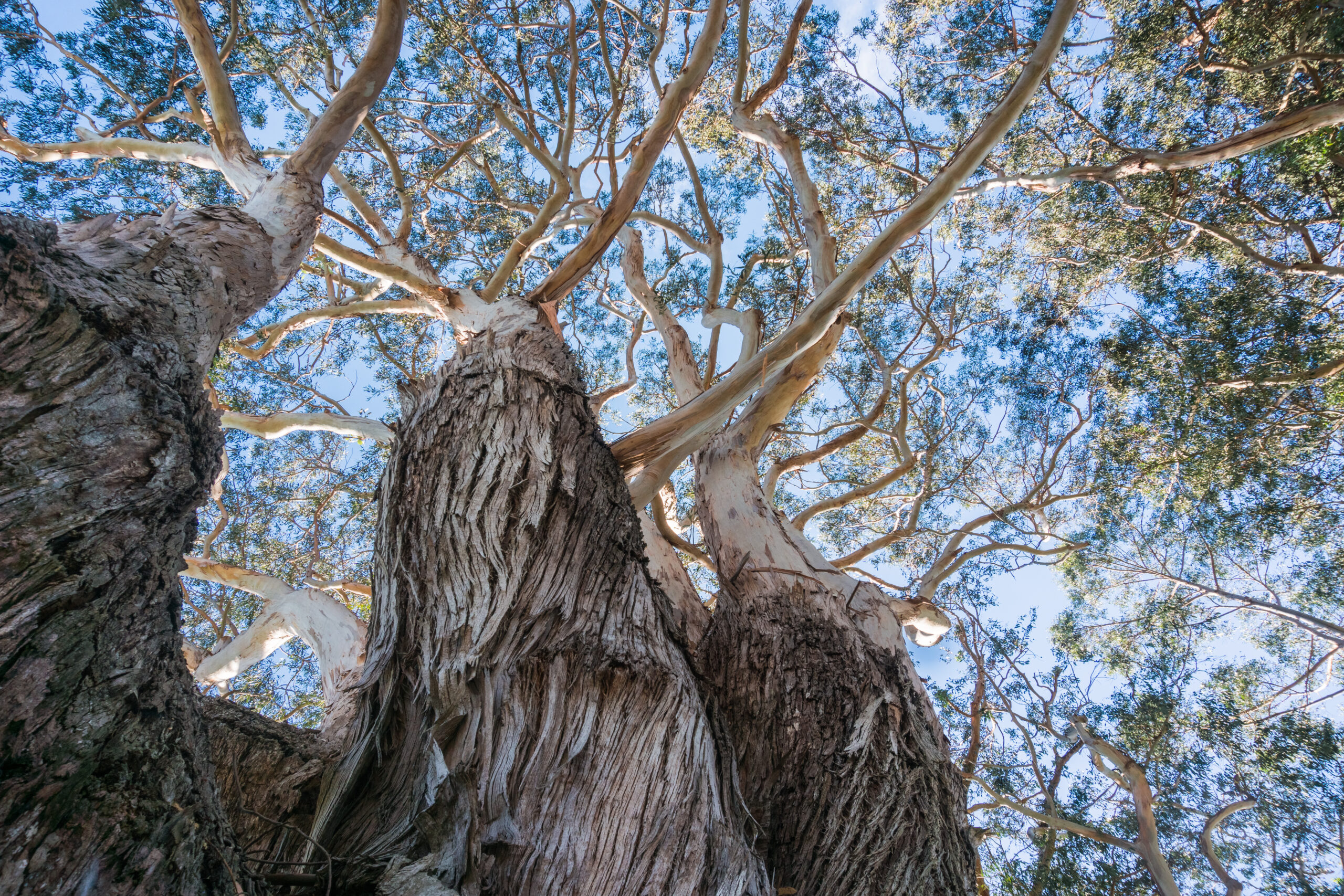
Temperate forest near mount Fuji, Japan
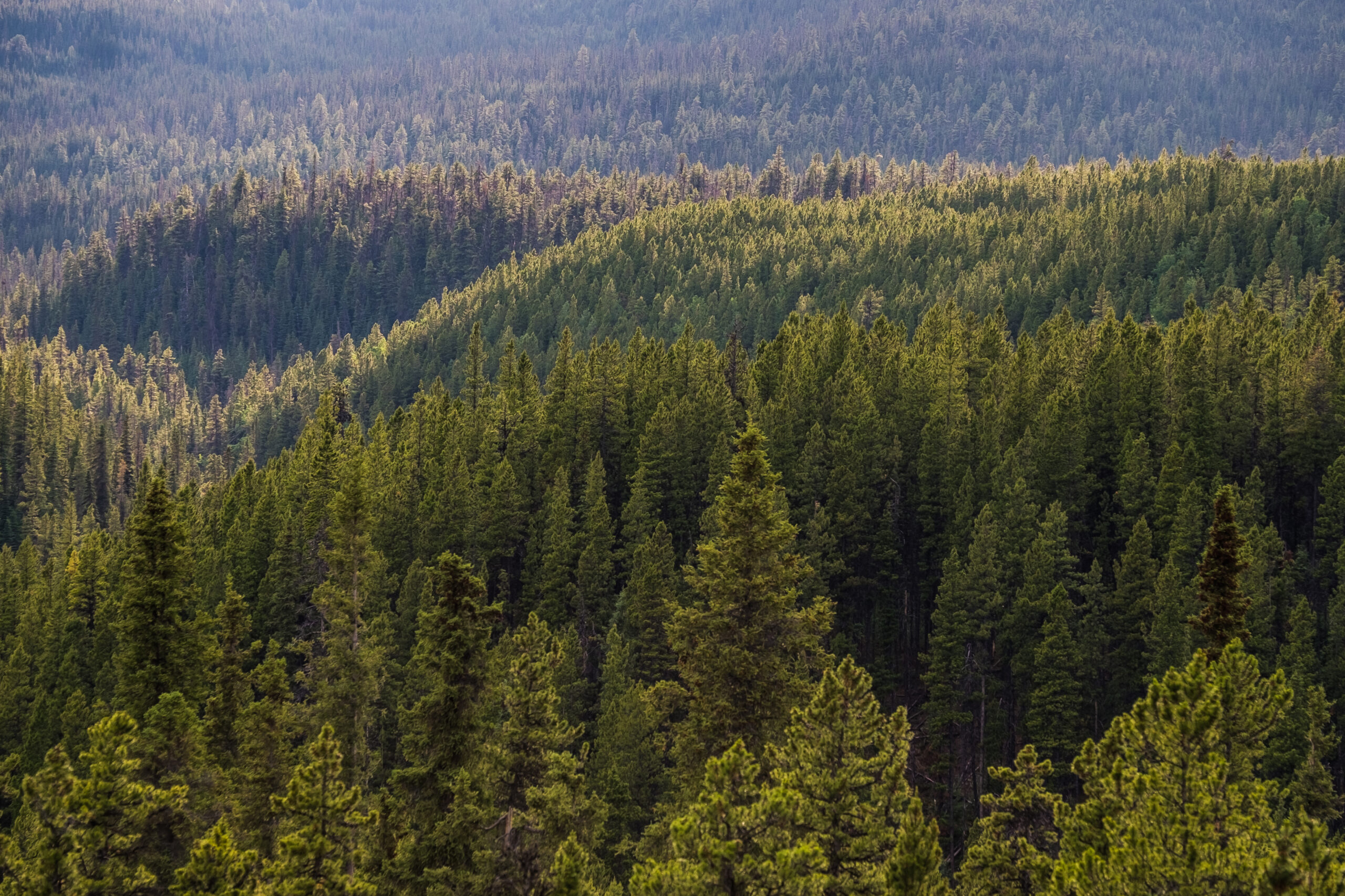
Taiga (Boreal forest) in Lappland, Northern Finland
Landscapes have been an inspiration to us for centuries, the subject of countless painters, writers, photographers and movie directors. The natural vistas of our home countries and foreign lands, perhaps more than anything else, determine that area’s character. And while these landscapes are shaped underneath by topography – the presence of coastlines, hills and mountains – their surfaces are defined by the degree of plant life growing upon them.
Principle Biome Plant Groups Earth’s vegetation is almost infinite in terms the variety of species that grow upon it. As plants are wholly dependent upon liquid water, what types of species grow where is determined primarily by annual patterns of temperature and rainfall in that area – the local climate. An abundance of heat and water produces the greatest growth potential, such as in the tropical rainforests, while lower temperatures or rainfall reduce such growth and shape the plant life in various ways so that it can survive drought and frost.
The main groupings of plant varieties in this regard can be thought of in the following way:
Trees – from the coniferous evergreens of the boreal forests, to mixed temperate woodlands and the evergreen broadleaf forests of the tropical regions
Shrubs – occurring in almost every climate zone, either as a junior partner in forests, or dominant as they are in semi-arid areas, such as the Mediterranean
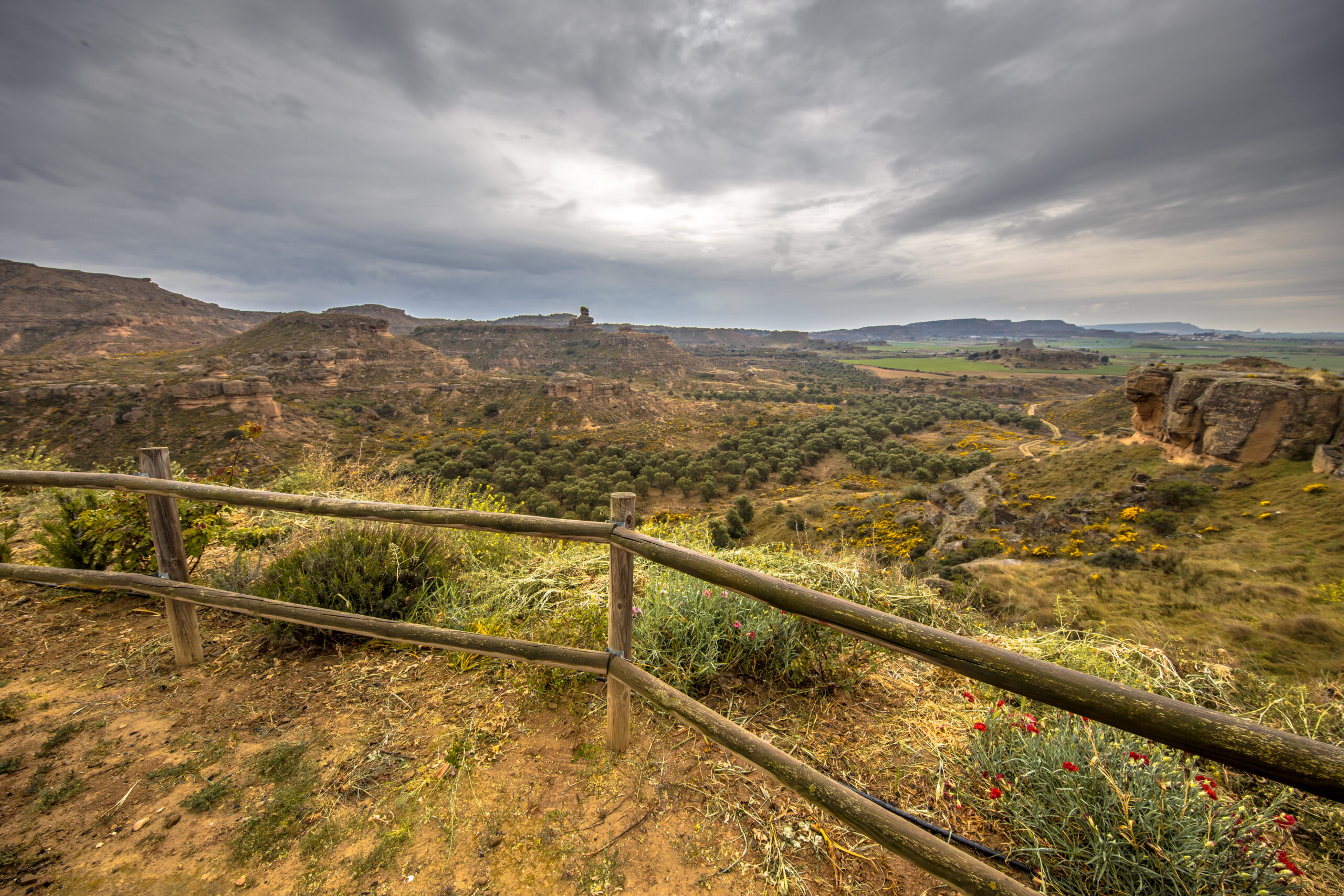
Grasses – again occurring in almost all areas, but known especially in their singular biomes of the tropical savannah, and the temperate prairie and steppe
Desert adaptations – with cacti being the most well known
Very cold adaptations such as found in tundra
These adaptations span the basic classes of plants in terms of evolutionary heritage. For instance, the class of flowering plants, known as angiosperms, are found in every category as just described.
Biome vs Climate Zone The term biome is often confused with the concept of a climate zone, but these are different in nature. A climate zone is defined simply by the patterns of rainfall and temperature, and these are discussed in detail in my Secrets of World Climate Series, which is linked top right. Biomes are the adaptations of plants, principally influenced by climate zones, but by other factors also.
Perhaps the most interesting of these is the different ways in which plants evolve in the same climate types, but isolated on different continents. For instance, eucalyptus forest dominates the eastern seaboard of Australia, which has the same humid subtropical climate to that of the south-eastern United States and Southern China, and yet we do not find eucalyptus in those other continents, but instead oaks or bamboo. In the opposite way, many species have adapted to live in multiple climate zones, for instance, the pine tree family can be found from the subarctic to the tropics.
A climate zone is simply the pattern of rainfall and temperature
South Eastern Australia, with a humid subtropical climate has eucalyptus forest …
… whereas the same climate in South China has bamboo forest.
Another influence is the type of soil that might be present in a region, from sand through to silt and clay. As the soil affects drainage of water away from roots, this affects what species will be present within the same climate zone since plants have different sensitivities in this regard.
So climate zones and biomes should never be thought of as synonymous. In fact the subject of biomes is significantly more complex because of life’s way of evolving along different paths through random mutations when presented with the same external conditions. This complexity is evidenced by the many different attempts to classify geographical distribution of biomes over the last century and a half with varying degrees of consensus. By comparison, climate classification has been dominated by a single figure in all this time – Vladimir Koppen.
The Holdridge Lifezones Chart On that subject, of climate, let’s return to that, and focus on how and why exactly differing patterns of precipitation and temperature can so markedly affect the type of vegetation covering an area.
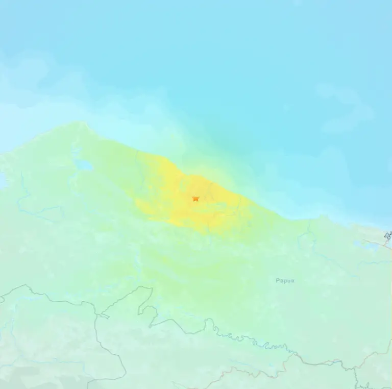
In the 1940s, Leslie Holdridge developed this graph showing how a combination of temperature and rainfall could produce the different biome types observed across the planet, what he call Life Zones. At first this looks like a beast of complexity, but if we break it down, it will make sense. From top to bottom we have increasing temperature, either from the poles to the equator, or the tops of mountains to the sea. On the right side of the triangle we have annual precipitation, from dry in the centre to wet on the right.
The Holdridge Lifezones chart
Evapotranspiration = direct evaporation from the soil + transpiration from plants
Comparison of Subarctic and Semi-Desert areas with similar rainfall, but dramatically different levels of biomass
The combination of temperature and rainfall yield a factor called the aridity index. It is actually the ratio of potential evapotranspiration to total rainfall. Evapotranspiration is the combined effect of direct evaporation of water from the soil plus the outward transpiration of water from plants through the gas exchange cells in their bodies. Potential evapotranspiration is the maximum possible amount of water lost in this way, assuming there would a limitless amount of water available. The highest temperatures combined with the lowest rainfall produces the highest aridity index, and this is where we find deserts capable of supporting little if any plant growth. Both cooler temperatures with weaker sun and consequent lower evapotranspiration or a wetter climate alike allow for plants and soil to retain more moisture and thereby increasing plant growth, and so at the opposite end we find rainforests, either of the tropical or temperate variety.
This concept is key in understanding how regions with differing rainfall and temperatures lead to different types of vegetation. It’s not simply about which areas have more or less rain. Take, for example, the boreal forests which have a similar total annual rainfall to the semi-arid Sahel just below the Sahara desert. Totally different biomes despite the similar rainfall totals. But because the boreal forests are much cooler, they can retain more moisture, leading to extensive biomass, whereas plants and soil in the hot Sahel lose much more moisture in comparison, leading to stunted shrub-like vegetation and plenty of bare earth.
The LONS08 Biome Classification System In this series we’re going to use the recent classification known as LONS08, based on Dorman and Sellers’ work of the late 1980s. This global map shows the thirteen different biomes delineated by this classification. Starting at the equator, and moving roughly outward toward the poles, these are summarised as follows:
Adapted World Map of LONS08 Biome Classification
Adapted World Map of LONS08 Biome Classification
Tropical Evergreen Forest – where tropical heat combined with year round rain permits broadleaf trees to retain their leaves permanently
Tropical Seasonal Forest – where tropical wet and dry seasons cause broadleaved trees to lose their foliage in the dry season
Savannah – where the tropical dry season is of sufficient length or severity that trees are largely replaced by grasses
Shrubland – where the challenges of wet and dry seasons both in the tropics and more temperate latitudes lead to a domination of shrubs interspersed with grasses
Semi-desert – similar to shrubland, but where the aridity index is so high that only hardy shrubs or specially adapted families such as cacti can grow
Desert – where the climate is so dry that virtually no vegetation is possible – the biome of bare earth
Prairie and Steppe – where a lack of rain combined with cooler temperatures in the mid-latitudes prevents tree growth and allows grasses to dominate
Temperate Forest – the classic broadleaf woodlands of the mid-latitudes, most of trees therein losing leaves in winter
Mixed Temperate Forest – where broadleaf and evergreen coniferous forests are mixed at the mid-latitudes
Boreal Evergreen Forest – where cooler temperatures in more polar latitudes lead to coniferous tree growth dominating in the vast expanse of the taiga
Boreal Seasonal Forest – like the taiga, but where winters are so severe that even the supposed evergreen conifers lose their needles in this season
Tundra – where summer temperatures are too low to allow for the growth of trees, leading to cold-adapted low-lying shrub-like vegetation
Ice – where no vegetation is possible due to year-round freezing conditions
In this series, we’re going to look at each of these areas in more detail, showing real examples of places where these exist, and the dominant species found in each.
Coursework Questions What is the difference between a climate zone and a biome? What are the five principle types of vegetation that exist for the purposes of biome classification? What is evapotranspiration and how does it determine the type of plants that will grow in a biome? Name 5 biomes, and briefly describe their nature.
It is fitting that we begin our journey across the biomes of Earth with the one that we perhaps hold the most dear in our hearts. The greatest biodiversity of any area of earth with over half of all plant and animal species. The lungs of the world – absorbing more CO2 and producing more oxygen than any other. A product of constant heat and abundant rain, it’s no wonder that plants grow here more vigorously than in any other biome. But it is also the biome that is under the greatest threat. Known as jungle, selva or rainforest, these regions are in fact two distinct biomes – the evergreen and seasonal forests of the tropics.
Description and Dynamics
Encircling the equatorial regions of our planet, conditions of constant heat, and plentiful rainfall produce the richest biomes of all, since such conditions are the optimum for plant growth. The biomes of the tropical evergreen and seasonal forests have the same basic components of tall broadleaved, hardwood trees dominating the biomass. But beyond this, their characters diverge out from that essential character.
The presence of evergreen or seasonal forest is determined mainly by the pattern of rainfall throughout the year. When there is a minimal to no dry season or where extensive flooding occurs after a wet season to help the trees through the dry, the trees retain their leaves and continue growing throughout the year. When there is a noticeable dry season and no flooding the trees shed their leaves to retain internal moisture, and cease growing. This is why they are known scientifically as tropical evergreen and seasonal forest.
In popular understanding, we think of these as the rainforest, but it should be noted, as we can see in Holdridge’s Lifezones chart, that rainforests can also exist in more temperate latitudes where cooler temperatures exist. This same chart also shows that as overall rainfall is reduced in the tropical band, rainforest gives way to progressively drier forests, and then to trees interspersed with grasses and shrubs, that we can no longer truly call forest, but is its own concept – that of the tropical savannah. We’ll pick that one up in the next chapter. For now, then, let’s address the forests of the tropical regions, and consider their common elements.
Tropical Evergreen Forests exist in a climate with no dry season, while Tropical Seasonal Forests are subject to wet and dry seasons
The Holdridge Lifezones chart shows that rainforest can exist in temperate as well as tropical climates
Anatomy in Cross Section
If we look at a cross-section of a typical tropical forest, we will find four distinct layers. Starting at the ground, and we have the forest floor, which is littered with fallen vegetation from upper layers. In the hot and wet conditions, and in the presence of huge numbers of scavenger insects, millipedes and the like, this litter is reduced rapidly. Combined with often heavy rainfall, this soil is further leached of nutrients, so despite the biodiversity going on above ground, the soil is remarkably poor. Due to the extensive leaf canopy above, only about 2% of sunlight reaches the ground in rainforest, and so undergrowth is generally quite sparse here, with selected low-lying shrubs with extra-large leaves battling to receive as much light as they can in the dim conditions. As we move out into seasonal forest, the canopy thins out, permitting more light to reach the ground, and with consequently more undergrowth. This trend continues until proper savannah conditions exist – a mix of trees interspersed at the ground level with thickets of shrubs and an abundance of grass.
The floor of a tropical forest, rich in decaying biomass
Between the canopy and floor lies the understorey
Above ground but under the canopy, we have the understorey, where still only 5% of light can penetrate the canopy in rainforest. Here are found shrubs as well as seedlings of the main tree species which will fully develop if a gap opens in the canopy due to the fall of another tree.
At around 20-40m in height we arrive at the canopy itself – an almost continuous layer of leafed branches of the main tree species that have grown to this height in competition with other trees for sunlight. This layer will absorb over 90% of the light falling on the forest. It has by far the greatest biodiversity of all the layers, and it is estimated that it is home to about half of all plant species on earth, since the trees themselves are usually covered in other plants, such as air-rooted orchids, and ground-rooted liana, or vines, that usually feed upon the host tree. Considered parasitic, these liana often connect trees together to act as highways for wildlife to move from tree to tree – from ants and lizards to rodents, sloths and monkeys. This layer, comprising most of the life of the rainforest, makes this biome unique among all on earth, as being the only one that is so distinctly far above ground.
The last layer, where very tall trees extend beyond the main canopy, growing up to 70 metres or more, is known as the emergent layer. Such trees, while basking in the fullest sunshine, have to be resilient to the fierce tropical sun, as well as resisting strong winds which are commonly found at this height.
The canopy is where most of the biomass in a tropical forest is found
The emergent layer sees particularly tall and resilient specimens surviving above the canopy
The tropical forests are believed to be the oldest of all earth’s biomes still in existence, being as much as 100 million years old. Compare this to the temperate forests at about 60 million years, and temperate grasslands at only 25 million years in origin.
Where in the world
So, where in the world do we find the tropical forests? As clued by their name, they occur only in the tropics, between 23 degrees north and 23 degrees south, where high temperature exist year round. In general there is a close relationship to the evergreen forests and the Tropical Rainforest (Af) and Tropical Monsoon (Am) Koppen climate zones, that have rain year round or for most of the year. Seasonal Forest is generally found on the periphery of these Koppen zones and most commonly within the Koppen Tropical Savannah (Aw) zone, which has longer or more severe dry seasons. There are exceptions to this relationship, some of which can be explained by extensive flooding from the wet season sustaining growth and leaf retention throughout the dry season. In other cases, higher altitudes, such as in SE Brazil, Colombia and Ecuador push the climate zone into a Subtropical Highland type of warm instead of hot temperatures year round, which is nonetheless still favourable to trees maintaining their leaves throughout the year.
The Tropical Koppen Climate Zones Af & Am closely match the extent of Tropical Forest Biomes, while Aw is a mix of Seasonal Forest and Savannah
Tropical Forests are also found at higher altitudes in Subtropical Highland climate zones (Cfb/Cwb) and in Subtropical Monsoon (Cwa) areas
Global distribution of Tropical Evergreen and Seasonal Forest
So, region by region, and starting in the Americas, tropical forests dominate Central America, with southern and western Mexico having seasonal forest, and as we travel further south, these become evergreen, all the way to the Pacific coasts of Colombia and Ecuador. Most of the Caribbean islands have either evergreen or seasonal forests on them, wherever they are exposed to moist rain-bearing winds.
Tropical Rainforest in Ecuador
Tropical Rainforest in Costa Rica
Seasonal Forest on Martinique in the Caribbean
South America has the most extensive tropical forests in the world, with the Amazon basin being the most famous, covering an area equivalent to the continent of Europe. Most of this is within Brazil, but it extends into the adjoining countries of the Guyanas, Venezuela, Colombia, Ecuador, Peru and Bolivia. The vast majority of this is evergreen, with seasonal forest on the periphery as it morphs into the Savannahs of Central Brazil, Venezuela and Bolivia. South Eastern Brazil has extensive seasonal forest, which becomes evergreen along much of the coast owing to moist trade winds year round.
Moving onto Africa, and we have the home of the second largest contiguous rainforest – that of the Congo basin. The entire coast of West Africa from Nigeria to Senegal has evergreen forest which, like the Congo, has an edge of seasonal forest before it transforms gradually into the extensive savannahs that dominate the continent. Evergreen and seasonal forests also exist in parts of Ethiopia where a subtropical highland climate exists, and the western and northern coasts of Madagascar, where favourable trade winds deliver plenty of rain year round.
Tropical Rainforest in French Guiana
Kambadaga Falls in Guinea, West Africa
Seasonal Forest on Palawan Island, Philippines
Onto Asia, now, and the Indian Subcontinent, which would have the largest area of tropical seasonal forest in the world if so much of it had not been cut down for agricultural purposes to feed the world’s second largest population. This natural vegetation type dominates here due to the dramatic shifts in wet and dry seasons brought by the Indian Monsoon, the world’s most extreme. Evergreen forests exist on the western coast of India where the monsoon rain is so high that the ground stays wet for most of the year. Flooding in the lower Ganges basin throughout the dry season also keeps most of Bangladesh in the natural evergreen type, although again, most of these forests are gone due to extensive agriculture to feed its massive population. The island of Sri Lanka is home mostly to evergreen forests due to its exposure to moist trade winds all year round.
The South East Asian nations of Myanmar, Thailand, Laos, Cambodia and Vietnam are home to a mix of seasonal and evergreen forests depending upon the drainage and retention of water as all these countries experience a significant dry season. The southern coasts of China all the way to Taiwan also have a mix of tropical forest types. As we move into the SE Asian archipelagos of the Philippines, Malaysia and Indonesia, however, the evergreen forest becomes dominant, and this, collectively, makes up the third largest rainforest in the world, with much of it still in its natural state, particularly on the world’s second and third largest islands – New Guinea and Borneo.
Seasonal Forest in Laos
Tropical Rainforest in Queensland, Australia
Tropical Forest on Maui Island, Hawaii
As we move into Oceania, and we have a narrow band of rainforest existing along the northern and north-western coasts of Australia, where exposure to most trade winds leads to plenty of rain allowing favourable conditions for evergreen and seasonal growth of tropical forest.
Lastly, we come to the Pacific, and all islands that lie within the tropical zone have evergreen forests, from the Solomon Islands to Fiji, Micronesia and certain coasts of the Hawaiian Islands that are exposed to moist trade winds for much of the year.
Species
As is well known, the tropical rainforests are the most biodiverse habitats on Earth, and this biodiversity runs across all kingdoms of plants and animals. As an example in one area of Malaysia of less than a quarter of a square kilometre, 375 different tree species with significant trunk diameters were recorded.
Most plants, including almost all of the trees are in the angiosperm group, namely, those plants that produce flowers. Among these are the more famous hardwoods such as mahogany, teak, ebony and rosewood. Hundreds of species within the palm family are also common. Coniferous trees, such as pine etc., on the other hand, are relatively rare in these parts.
When we move into the seasonal or “dry” forest, where trees lose their leaves in the dry season, biodiversity is significantly less, and in contrast to the multi-species canopies of the rainforest, often the forests can be dominated by a single species over wide areas, such as the teak forests of Myanmar.
Tree species distribution varies geographically, and is roughly divided into three subkingdoms. The Neotropical, African and Malenesian. In Central and South America, mahogany, cedar, myrtle, laurel, palm, acacia, rosewood, brazil nut are common. In Africa we find mahogany again, along with ebony, limba, wenge, agba, iroko and sapele. In SE Asia, in addition to the well known teak, a significant proportion of trees belong to the dipterocarpus family, while others include durian, sandalwood and ironwood.
Tropical Forest species are broken down largely by continent
Some South American Tropical Forest tree species
An African Tropical Forest tree species
Some SE Asian Tropical Forest tree species
Threats
In closing, we come, sadly, to the issue of the destruction of this biome – one practically all of us are aware of, especially in a year of unprecedented burning of forests in Brazil and Bolivia. At one time logging of prized tropical hardwoods was considered the greater threat. But, like so many other biomes worldwide, it is farming that is now the greatest threat to forests of the tropics. In Bolivia and Brazil, illegally burning the land to then claim it as “dead” land that can be used for cattle ranching is being carried out to circumvent the usual rules that prevent such claims. While in South East Asia, habitat destruction is now at a scale never been seen, much of it being due to the demand for palm oil. I have seen with my own eyes, from the air, vast swathes of the forests of Indonesia and Malaysia turned into the hexagonal monoculture of palm oil plantations. Many of you might think, no it’s not possible that the rainforests could disappear – they’re too big, and just too precious. Well, if you need any precedent for this, look at the forests that once covered England, or India, or the prairies that once covered a dozen states of the USA. You can’t, because they’re not there anymore. Destruction of natural habitats is very much in our history, stretching back thousands of years. And unless we learn how to accommodate the needs of a growing population throughout the tropics, then we may lose the most precious biome of all.
Coursework Questions
What are the two types of tropical forest biomes and how do they differ?
Why is the Tropical Seasonal Forest so named?
Briefly describe the four vertical sections of a tropical forest.
What Koppen Climate Zones are related to the tropical forests?
List out some countries and regions that have tropical forests.
What are the three broad families of tropical forest species, and where are they found?
List out some tropical forest tree species.
Are the tropical forests under threat? Is there an historical precedent for other biomes being almost wiped out? Briefly discuss each.
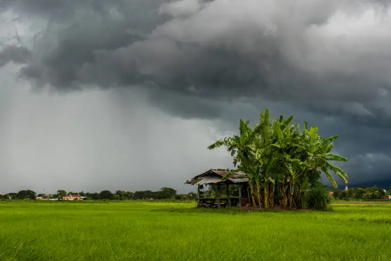
The vast open country of the tropics. A patchwork of trees and shrubs on a bed of grass. A place of deluge and drought. It dominates the continent at the centre of our world, and of all the world’s habitats, this one supports the earth’s most famous wildlife. The home of the safari. This is the Savannah.
Description and Dynamics
The tropics of our planet have two habitats that are instantly recognisable to us. The first of these we have already covered – the tropical rainforest. The other, much drier one is that of the tropical savannah. Spreading out over vast plains across three continents, the Savannahs of the tropics make up for any lack of biodiversity compared to their richer rainforest cousin in sheer quantity of large mammalian wildlife, feeding on the endless grass, and on the animals that eat that grass.
When many of you think of Savannah, you probably think of vast uninterrupted plains of grass, such as the Serengeti so often shown on our TV screens in wildlife documentaries. But Savannah is in fact a mix of trees, shrubs and grasses. Annually, between wet seasons, conditions of severe drought limit the forest development, widening the gap between trees, and allowing plenty of light to reach the ground. This leads to thickets of shrubs or extensive grass cover to fill in the gaps. And as in the adjoining tropical seasonal forests, trees here survive the dry season by dropping their leaves.
The Koppen climate type that dominates these regions is named after this biome – Tropical Savannah, so closely do the regions match in geographical extent.
Savannah is not just open grassland, but also a mix of trees and grass
The Tropical Savannah Koppen climate type is so named as it closely matches in geographic extent the Savannah biome
If we consult our Holdridge Lifezones chart, we can find savannah to the left of tropical forests, where overall rainfall is reduced, and where it is described as either thorn steppe or woodland, or very dry forest. But this chart tells only half the story, as it is the drought of the long dry season in these areas, rather than the overall amount of rain, which influences their character most strongly.
In the Holdridge Lifezones chart, Savannah can be found as Thorn Steppe / Woodland, Thorn Woodland and Very Dry Forest
Savannah exists only in tropical areas where there is a marked wet and dry season
Savannah is really a transition zone between Tropical Forests and Scrubland or Desert
Savannahs are really transition zones between the verdant rainforests of the tropics and the parched hot deserts of the subtropics. They don’t suddenly begin or end, but rather merge into the tropical forests on the wetter side, and into scrubland on the drier side. The amount of tree canopy cover percentages that determines whether the land can be referred to as Savannah is subjective, but can be anywhere between 5 and 80%.
Global distribution of the Savannah biome
With such extensive dry seasons in these parts, it’s no surprise to find brushfires here. In fact all the plant species have evolved to survive regular fires in various ways. Such is the effect of fire, that it is believed many of the world’s savannah regions have developed as a result of human fire activity over many thousands of years, where, without this, tropical forests would have been present.
Where in the world do we find Savannah?
If we apply the strict definition of a natural mix of trees, shrubs and grass, then savannah occurs in temperate and subtropical latitudes as well as the tropics. But these areas are relatively small compared to the tropical savannah that dominates the tropics, in South America, Australia, and above all, Africa. I’ll mention a bit more about these other areas in the chapter on Grasslands. But for now, we’ll continue our focus on the tropics.
Region by region, then, Savannahs are found in the Americas, in isolated strips in southern Mexico, some Caribbean islands, in particular Cuba, and in Southern Florida, where, in fact, the Everglades are a flooded form of Savannah.
The Everglades in Florida are in fact a form of flooded Savannah
Venezuela has extensive Savannah in the central part of the country. Image courtesy of Pedro Matute
Brazil has some of the most biodiverse Savannah in the world. Image courtesy of Ricardo Madeira de Albuquerque
Much of the ‘Outback’ in Eastern Australia is Savannah
South America has more extensive Savannahs, including most of the central part of Venezuela, while central Brazil has vast areas of broken woodland, in what is known as the Cerrado. The Brazilian Savannah is the most biodiverse in the world, with an estimated 800 tree species alone.
Skipping over to Australia, and we find extensive parts of the Outback in the form of broken woodland, shrubland and grassland that meets the Savannah definition, as a wide transition zone spreading across the north and east of the island continent, between the coastal forests and the parched desert interior. Species transition gradually from tropical varieties in the north to more temperate forms in the south in the area shown on this map.
And last, but not least, we come to Africa, the place that comes to mind with most of us when we hear the word Savannah. This continent is dominated by this biome, extending in a wide band across West Africa through to Ethiopia in the north-east. This band follows tight lines of latitude, classically representing the transition between the equatorial forests to the south and the vast Sahara desert to the north. In East Africa, the presence of wide plateaux across the equator leads to drier conditions and the formation of the most famous of all savannahs, the Masai Mara of Kenya and Serengeti of Tanzania.
Classic broken tree-and-grass-scape in Mali, West Africa
The famous Masai Mara Savannah in Kenya
Fully open Savannah in Masai Mara, Kenya
South of the equator and these savannahs spread out around the south of the Congo rainforests to cover Southern Africa from coast to coast, with only the deserts of the south-west being exempt. The wet and dry seasons across these regions extend also into Madagascar where, as always with this island of unique biodiversity, a Savannah exists here in a form unlike any other.
Aerial view of Savannah in Eastern Namibia
Elephants in the Savannah ‘bush’ of Eastern South Africa
Aerial view of broken tree and grass Savannah in South Africa
The alien landscape of baobab trees in Madagascar. Image courtesy of Rita Willaert
Species
Species of trees, shrubs and grasses vary by continent. In the Americas the most common broad-leaved trees are Curatella, locustberries, maricao cimarrons and Bowdichia, while Copernia and Mauritia palms are commonly found in more flooded areas. Cutgrass and bahia grass are among the more common ground coverings.
South American Savannah plant species 1
South American Savannah plant species 2
South American Savannah grass species
In Africa, the most iconic of all Savannah trees, the acacia and the baobab are commonly found over wide areas, with Acacias dominating in the East, and Baobabs in the South and Madagascar. Bushwillows are most common in the West, while sturdy Borassus palms are found in many places. Brachystegia are found in wetter savannahs, while drier areas are often dominated by thickets of thorny shrubs. Ground coverings include bluestem, thatching, elephant and kangaroo grasses.
African Savannah Acacia and Baobab
African Savannah Bushwillow and Borassus
African Savannah Brachystegia tree
African Savannah grass species
Australian Savannah is, unsurprisingly, dominated by Eucalyptus trees, which retain most of their leaves throughout the dry season by a special adaptation. Acacias and baobabs, however, are also found in North-Western parts. Tall spear grass and shorter kangaroo grass form the understory of large areas of moist savannah, while prickly spinifex grasses are prominent in more arid regions.
Australian Savannah Eucalyptus
Australian Savannah Baobab
Australian Savannah grass species
Dare we mention fauna? Although this series is about the botany across Earth, no mention of the Savannah can go without its greatest claim to fame, that of huge volumes of large mammalian species found in particular in that continent of the safari, Africa. The presence of extensive grasslands provide feeding grounds for vast herds of elephants, rhinos, giraffes, wildebeest, zebras, buffalo and antelope. And with such herds, predators follow, in the form of lions, cheetahs, hyenas and African wild dogs. Nowhere else on earth do we find such a rich quantity of large animals, and this, more than anything, is perhaps the Savannah’s greatest gift.
Coursework Questions
Is Savannah just grassland? Describe what it actually is.
What type of climate results in Savannah landscapes? Mention both temperature and rainfall patterns.
Savannah is really a transition zone between what other biomes?
List some countries and regions where Savannah can be found.
List some Savannah plant species. Include both trees and grasses.
Often overlooked, these relatively arid regions of earth take second or third place to forests or grasslands when it comes to beauty contests. Too dry for trees to flourish, we’re left with a mix of shrubs and grasses, spanning the subtropics to the temperate latitudes. Having a surprising biodiversity considering their parched appearance, these areas are known by an equally diverse set of names, from scrub or scrubland, to bush, brush, heath, matorral and chaparral and more. A place of heat and drought, yet still abundant life, these are the shrublands of our planet.
Description and Dynamics
Shrublands are a relatively open form of country that regularly experiences drought. The defining vegetation is shrubs and grasses. Shrubs, like trees, are woody plants that possess lignin that allows the plant to retain the growth of previous years and build upon it with new growth the following year, as opposed to grasses and other plants that die back and must start again from rootstock or even new seed in the next growing season. In contrast to trees, however, shrubs are stunted in growth, and typically do not exceed 5 metres in height from a single stem, or 10 metres if multi-stemmed. But where shrubs lack height, they make up for in hardiness, and in comparison to trees are much more drought-tolerant, allowing them to thrive in many regions of the world where trees are absent.
These areas are always the result of a severe dry season, or irregular patterns of rain that lead to very long droughts, but occur in two very different climate types.
In the case of the subtropics, shrublands are simply transitions between the savannah and desert, where alternate wet and dry seasons exist, but where the wet season is of insufficient weight or length to allow tree growth. Such Koppen climate zones in this case would be in the crossover of Tropical Savannah (Aw), and Hot Semi Arid (BSh) areas.
But shrublands are best known for being found in the temperate latitudes of the Mediterranean basin and in other parts of the world that have the Mediterranean climate of a hot, dry summer and a cool wet winter (Csa). Despite being temperate, this unique climate, the only one with a dry summer and wet winter, creates a particular stress on plants, where the dry season occurs at the hottest time of the year – evapotranspiration from the plants is greatest when the least amount of water is present in the soil. No trees are able to survive these conditions, despite the winter rain, and so instead, we find a mix of shrubs and grasses.
Subtropical scrub is a transition between Savannah and Desert areas
Mediterranean scrub comes from the stresses on plants of a hot dry summer in temperate areas
The Holdridge Lifezones chart shows shrublands as desert scrub on the margin of desert across tropical and temperate latitudes
If we consult our Holdridge Lifezones chart, we can find these areas as desert scrub, spanning the tropics through to more temperate regions, but always where the annual rainfall is relatively low.
Shrubs can also exist as the principal vegetation in the transition between boreal forest and tundra in the far polar latitudes. But as these conditions are so different to the other two mentioned, and are principally a result of insufficient summer temperatures, we’ll discuss these areas in the Polar Biomes chapter.
With such severe dry seasons, it’s no surprise that fires are common in these regions, and at some point all of us will have seen on the news brushfires threatening the fringes of Los Angeles or in parts of the Mediterranean. Growing up in Adelaide, Australia, which is within this biome, I personally recall seeing a blackened sky on the horizon as fires would engulf the surrounding brush after a long dry summer.
Where in the world – Subtropical
So where in the world do we find the shrublands? Well, as mentioned, they occur in the subtropical transition zones between savannah and desert, and also in the Mediterranean climate zones of the temperate latitudes.
We’ll first take a look at the subtropical scrub areas, starting with the band that surrounds the Sierra Madre mountains of Mexico, from Texas down to central Mexico on the eastern side, and from Chihauhua down to Jalisco in the west.
On the NE tip of Brazil we find an extensive thorn scrub known as Caatinga or “White Forest”, which is brought about due to fast draining soils and irregular rainfall patterns and droughts, and is the driest part of this large country.
In the heart of South America, running down the eastern side of the Andes in a wide plain from Bolivia, through Paraguay to Argentina, we have the extensive scrubland known as El Gran Chaco, probably the largest such contiguous area on Earth.
Subtropical scrub in SW Texas, USA
‘Caatinga’ subtropical scrub in NE Brazil. Image courtesy of Terra Negra
Subtropical scrub in ‘El Gran Chaco’, Paraguay. Image courtesy of Gmmv80
Subtropical scrub in South Sudan. Image courtey of SOS Sahel UK
Global distribution of the Subtropical and Mediterranean Shrublands
Onto Africa and subtropical scrub acts as a transition between the Savannah to the South and the Sahara desert to the north in a narrow band that runs almost exactly east-west. Southern Ethiopia, Somalia and northern Kenya also have extensive scrub areas, as do parts of Botswana and Namibia, again acting as transitions between Savannah and desert – in this case the Namib and Kalahari.
In India – we have two distinct bands of scrub, one in West India which is a transition between the Thar desert of the west, and the more fertile plains of the centre. The other runs down the central and eastern part of the Deccan plateau, and is formed due to rain shadow from the prevailing SW Monsoon.
The last area that features subtropical scrub occurs in northern Australia, again acting as a transition zone between the northern savannah and semi-arid heart of the island continent.
Where in the world – Mediterranean
In the five Mediterranean climate zones of our planet we have the other, temperate, form of shrublands, resulting from hot and dry summers.
In Southern California, this is known as Chaparral, and still extensively covers the hills from Santa Barbara, through Los Angeles, and San Diego and down past Tijuana into the northern Baja peninsula.
In Central Chile we have a narrow strip of scrub between the Pacific Ocean and the Andes mountains known as Mattoral, named by settlers after the equivalent biome found in Spain.
Mediterranean scrub in Big Sur, California, USA
Mediterranean scrub (‘Mattoral’) in Catalonia, Spain
Mediterranean scrub (‘Garrigue’) in Southern France
Mediterranean scrub in Croatia
In the Mediterranean basin itself, we have the largest area of temperate scrub, running from southern Portugal in the West, into the Mattoral that covers large parts of Spain, while in north Africa, the northern parts of Morocco, Algeria and Tunisia are dominated by this biome. In Southern France, the scrub is known as Maquis and Garrigue, depending on elevation and vegetation density. Sardinia, Sicily and the west coast of Italy also have this biome, where it is known as Macchia. Greece is dominated by scrub, where it is known as Phrygana (Φρύγανα), and this Mediterranean scrub extends into significant parts of Turkey, as well as Cyprus and finally Lebanon and Israel at the sea’s eastern end.
Most of the southern cape of Africa has narrow band of temperate scrub where it is known as Karoo or Fynbos, which is the most biodiverse of all scrubland areas, and possessing thousands of unique species found nowhere else.
Lastly the south-western and south-central parts of Australia have their own form of temperate scrub in large areas known as Mallee and Kwongan, where dwarf forms of eucalyptus dominate.
Mediterranean scrub (‘Phyrgana’) in Crete, Greece
Mediterranean scrub in Western Cape, South Africa
Mediterranean scrub (‘Mallee’) in South Australia
Species – Subtropical
Plant species diversity in the shrublands is high. If we look first at the subtropical scrub areas, starting in Texas and Mexico, to the east of the Sierra Madre common species such as Mesquite, Yucca and Prickly Pear cacti can be found. In the Caatinga “White Forest” of NE Brazil, drought-hardened species such as Joazeiro, Bombacae and various cacti species such as Facheiro are common. In the vast Chaco of Bolivia, Paraguay and Northern Argentina, we find parklike vegetation of palms mixed with grasses in the wetter parts, while in the drier areas, drought hardened shrubs like senna, as well as a number of cacti species can be found.
North American subtropical scrub plant species
Brazilian scrub plant species
El Gran Chaco scrub plant species
In the Sahel of Africa, the long band of scrub to the south of the Sahara, we find dwarf acacias being the dominant species, while other shrubs include myrrh, and spiny grasses such as Panicum. East of the Deccan plateau in India, thorny scrub dominates, with Acacias, being the most common family also. Palms can be found in the wetter parts, while the driest areas include hardy species such as Euphorbia. In northern Australia, the band of scrub separating the Savannah and desert interior is dominated again by Acacias, especially the species Mulga while spinifex and triodia grasses cover the ground.
African Sahel scrub plant species
Indian scrub plant species
Northern Australian scrub plant species
Species – Mediterranean
In terms of species and biodiversity, the temperate shrublands are greater than the subtropical forms, and remarkably so when considering the challenging drought conditions experienced each summer. Because the temperate scrub areas are isolated from each other, each of these five zones has developed unique species that do not exist in the other zones, although there are some common relations between the areas within each hemisphere – for instance California and Mediterranean areas both have oaks, while Acacias can be found in Chile, South Africa and Australia.
Looking in detail at each of these five areas, and in California we can find a variety of oaks that are stunted due to the summer drought conditions, such as the Coast Live Oak, as well as a variety of Manzanitas or Bearberrys, Garrya, Rhus and Ceanothus.
In Chile we find Acacia, Baccharis and Prosopis, the latter occurring also on the other side of the Andes in the Chaco.
As mentioned previously, the Fynbos biome of the South African Cape has the largest number of scrubland species anywhere, with prominent families including Aspalathus (from which Rooibos tea is made), Senecio and Erica heathers.
Southern California scrub plant species
Chilean scrub plant species
South African scrub plant species
Southern Australian scrub plant species
South-west and south-central Australia are dominated by the mallee – dwarf eucalyptus which invariably grow as multi-stemmed plants from underground tubers. Other prominent species include Banksia and Conospermum.
Lastly, in Europe and the Mediterranean basin itself, we find a variety of dwarf oaks such as the Cork and Kermes Oaks, the Arbutus family that includes the strawberry tree (no they aren’t actual strawberries), Cytisus and Pistacia.
Mediterranean basin oaks in the scrub
Mediterranean basin scrub plant species
The Olive Tree of the Mediterranean basin – perhaps the most famous of all scrub plants
And finally, found throughout the Mediterranean is the most famous of all scrubland plants – the olive tree (Olea Europaea). These “trees” are technically shrubs, since they rarely grow beyond 10 metres in height, and are famed for their fruit which produces oil consumed by humans for millennia. The plants are highly drought resistant, and can live for thousands of years – that you could see some of the trees that Caesar or Aristotle may have taken shade under is something to wonder at.
Since shrubs have adapted to become highly drought and fire tolerant, their foliage is not very nutritious and often contains toxic chemicals, so animal numbers in these parts are typically low compared to Savannah or forest.
The leather leg coverings called ‘Chaps’ provided protection from the dense thorny shrub thickets in the ‘Chapparal’ scrub of Southern California
So while we might not hold the shrublands as dearly as their big brother forests, these biomes nonetheless get plenty of airtime. If you’ve ever watched any American television or movies, chances are you’ll have seen scrubland in outdoor shots, as so many movies of the past were filmed out of Hollywood, and the countryside surrounding Los Angeles is the type of Mediterranean scrub referred to as chaparral. This, incidentally gives us the word for “chaps”, because the chaparral, like most shrublands can often be a giant thicket of thorny shrubs, and leather protection to the legs was necessary to prevent being scraped to death while on foot or horseback.
And the shrubs of these regions, due to their manageable size compared to trees, and their hardiness, have become favourites of the average domestic garden not just in regions native to this biome, but in cooler and wetter climates such as those of Great Britain, a long way from the parched and baked lands of the scrub.
Coursework Questions
What is scrub or shrubland composed of?
What is the principle climatic reason for scrub vegetation?
What are the two main types of scrub, and in what regions of the world are they found?
List out some countries where scrub is found and what parts of those countries its found in.
List out some scrub species that you have already heard of.
This is what the bare earth looks like, the bones of our planet revealed as the skin of vegetation is peeled back. Despite the lack of life, these landscapes nonetheless inspire us with their stark beauty. A product of endless sunshine and droughts, life yet still finds a way here, for plants to survive in these regions have gotten smart. One of the most extreme biomes on our world, from the Sahara to the Sonora, the Gibson to the Gobi, these are the deserts of planet Earth.
Deserts are among the most open form of country of earth, where vegetation is sparse or effectively absent. The cause of this is simple enough – it’s just a lack of water. Plants, like all forms of life, need that universal solvent, and when it’s sparse, they struggle, and in order to survive, they must get creative. Deserts exhibit some of the most interesting and strange forms of plant life to be found anywhere in the world.
The strict definition of deserts in the biome classification system we’re using in this series, known as LONS08, is any biome containing bare earth, either in part between grasses, shrubs or trees, or completely bare. This distinguishes the deserts from other desert like biomes, such as scrub, since the latter will always have a complete covering of grass at ground level between the shrubs. But while shrubs and grasses, and occasionally even trees, are also often present in deserts, they are separated by sections of bare earth.
Deserts occur over extensive parts of the continental surface of the earth, present on every continent, and are in fact the largest biome in terms of land area. They are basically subdivided into four forms, hot and cold, arid and semi-arid. Arid deserts have practically no vegetation, while semi-arid regions contain a mix of plants separated by bare earth as described a moment ago. Hot deserts occur in the subtropics and are characterised by mild winters and very hot summers, while cold deserts occur in the temperate latitudes and although they still have relatively hot summers, experience winters that can be brutally cold. These elements, hot and cold, arid and semi-arid are mixed up in various ways to produce biomes that are unique within the greater sphere of deserts.
The correlation between hot and cold deserts and their corresponding Koppen climate zones is very clear. Hot desert areas occur in regions defined by the Koppen Hot Arid (BWh) and Hot Semi-Arid (BSh) zones, while cold deserts are found in the Koppen Cool Arid (BWk) and Cool Semi-Arid (BSk) zones. The climate phenomena and causes of these four basic types are discussed at length in the two chapters of my Secrets of World Climate series that relate to deserts – Hot Deserts and Cool Deserts.
If we consult our Holdridge Lifezones chart, we can find the deserts at the extreme left of the diagram, where rainfall is at its lowest. Note that the deserts span every latitude of earth, from the tropics to the poles. Although parts of Antarctica are the driest on Earth, these regions are classified within the Ice biome since the perpetually cold temperatures on that continent are considered to be the defining characteristic over any localised absences of precipitation. The aridity index – the ratio of evapotranspiration to available water – is at its highest anywhere on earth in the hot deserts of the subtropics, where searing temperatures combine with a near-absence of rain to make any plant growing extremely difficult.
Hot Deserts have mild winters and either low levels or almost total absence of rain
Cool Deserts have cold winters and either low levels or almost total absence of rain
The correlation between Koppen desert climate types and desert biome extent is very clear
In the Holdridge Lifezones chart, deserts are found at the left hand side, where rainfall is lowest
The deserts are the only biome where, mostly or completely devoid of vegetation, the bones of our planet are laid bare. These “bones” come in many forms. Astronomically, earth is regarded as a rocky planet, and beneath any vegetation, or oceans, its crust is some form of rock, usually oxides of silicon mixed with other minerals. These other minerals, and the way in which these rocks were formed beneath the earth, give them different colours. So where you see deserts, these exposed rocks reveal their many colours, from the white of sodium and calcium salts, to the red of iron, the black of basalt, and the beige of sandstone, the colour most commonly associated with deserts.
Lacking cloud cover, deserts have high ranges in temperature from night to day. In a process called weathering, these temperature changes stress the rock where it is exposed, and eventually break it up, depositing it in heaps of shattered rock below, known as scree. Additionally, with little root vegetation to hold onto it, desert winds, laden with sand, further wear at the rocks to create more sand, and in places, this sand gathers in enormous dunes. Dunes spread out over a wide area are referred to as ergs, and some of these ergs can stretch for thousands of square kilometres, such as those found in the Taklamakan desert of Central Asia.
Salt is a common feature of this biome. Rivers running into deserts very often end there, due to evaporation from the intense sun, and as they dry out, they deposit any salt dissolved within. In geological times past, ancient seas once connected to the oceans were cut off, and, within the parched desert climate, dried out to form salt lakes. So very often the soil is salty, and as a consequence many desert plants have adapted by becoming highly salt tolerant and such plants are called halophytes, after the Greek word “halas” for salt.
The desert biomes collectively are the largest on earth by land area
Plants that can withstand extensive droughts, on the other hand, are called xerophytes, after the Greek word “xeros” for dry. The mechanisms of how such plants deal with drought is numerous, but all centre around retaining as much moisture as possible from the infrequent rains that might come their way. Moisture in plants is lost through leaves, and in particular through stomata, the breathing holes in leaves that exchange CO2 for oxygen. Since sunlight is readily available in deserts, small leaves are standard for desert plants, since these leaves provide enough for photosynthesis, but are kept small to reduce moisture loss. Others keep their stomata closed during droughts, preventing growth, but also greatly reducing moisture loss.
Another adaptation is storing as much water as possible within the plant itself, and this is the defining characteristic of the class of plants known as Succulents, which have thick fleshy stems and leaves. The most well-known sub-class of the succulents is, of course, the cactus family. Despite being only found only in the Americas, cacti are regarded as the iconic desert plant, and could be mistaken for naturally occurring throughout the world, when they are not. Cacti’s excellent ability to store water is well-known – in the case of the Saguaro cactus, one of the largest, a fully grown specimen can soak up to 200 gallons of water after rainfall.
In these brief interludes between the long droughts, when rain comes to the desert, the plants therein frantically attempt to reproduce, and so a desert will bloom in a riot of wildflower colour after a rainstorm, transforming the landscape overnight.
So where in the world do we find the deserts? Starting in North America, in the Western half of the United States we have the extensive Great Basin cold desert of Nevada and Utah, while further south, and at lower altitudes, we have the hot deserts of the Mojave, Sonoran and Chihuahuan deserts extending from Southern California, through Arizona and New Mexico, down into most of north and western Mexico.
Much of the Western USA is high altitude desert, such as the Monument Valley, Arizona/Utah
Death Valley, California, USA, has the record for the highest temperature globally and is part of the wider Mojave Desert
Saguaro cactus covers much of the Sonoran desert in Southern Arizona, USA
In South America, we have two principle desert regions. Practically the entire long coastline of Peru is extremely arid desert, second only to the Atacama of Chile, the driest of all deserts. These deserts are so dry due to a combination of being between a cold ocean current in the Pacific, which prevents any formation of rain through onshore winds being warmed by the land, and the very high Andes, which block moist trade winds coming down from the Amazon. This cold current keeps these subtropical deserts mild, rather than hot, and temperatures rarely exceed 30 degrees in the summer. Further south and on the opposite side of the Andes, we have the hot semi-arid deserts of North-western Argentina that continue south down to the tip of that continent as the cold desert of Patagonia.
Skipping across the South Atlantic and we reach Namibia and Western South Africa, where the arid Namib desert of the coast extends inland to the more semi-arid landscapes of the Kalahari bushland.
The European Southern Observatory high in the Atacama Desert, the driest in the world
Patagonia, in Southern Argentina is cool desert, due to rain-shadow from the Andes
Namibia in SW Africa has the Namib (arid) and Kalahari (semi-arid) deserts
Heading north, and in Europe, we can find some localised semi-arid regions in Eastern and Southern Spain, while the Canary Islands to the south west are mostly desert at the lower elevations. East of the Canaries and we arrive at the world’s largest, and most famous desert, the Sahara. Most of this hot desert is so dry that it supports almost no vegetation, with semi arid conditions occurring on the northern and southern fringes. This desert continues east into the Horn of Africa, and the Arabian and Syrian deserts of the Middle East, which have alternately arid and semi arid conditions. This region is further connected to the Iranian plateau where cool deserts are found, and east again into the Baluchistan desert bordering Pakistan and ending in the Thar desert of North-west India. Connected to the North of this region are the cool deserts of Central Asia, with the Karakum of Turkmenistan being among the most arid. The semi arid conditions north of here encompass most of Kazakhstan and where these merge into the Russian steppes defines the actual border of these two large countries. East over the Altai mountains, and we find the Taklamakan desert of Western China, one of the most forbidding of all deserts, such is its aridity and freezing winter temperatures. This desert is connected to the north east to the most famous of cold deserts, the Gobi of Mongolia and northern China.
The Eastern Atlas Mountains in Morocco form the NW edge of the Sahara
Egypt marks the NE edge of the Sahara
Most of Iran is hot or cool desert. Image courtesy of AsuhsWorld
Lastly, in Australia, the driest of all continents, we have semi-arid conditions making up most of this country. Extending from the coasts of Western Australia, through the “red centre” to the fringes of the savannahs that run down the eastern side of the continent.
The Taklamakan Desert in NW China is one of the most forbidding environments on earth, due to its extreme temperatures and aridity
The Gobi Desert of Mongolia is vast, and known for its exceptionally cold winters. Image courtesy of Thomas Noisel
Most of Australia is composed of semi-arid desert like this scene
In contrast to the isolated regional development of species in the Shrublands that we discussed in the last chapter, deserts have much more extensive contiguous ranges, allowing individual species to spread over wide areas. Several plant families have colonised most of the globe including that of the Daisy family and the Frankenia family of flowering shrubs. The Artemisia family are found across all northern hemisphere deserts, including sagebrush and wormwood, while the Chenopodium and Atriplex families are both referred to, rather confusingly, as saltbushes, and are found in every continent.
If we look at regional variants, and firstly in South America, west of the Andes along the Peruvian coast and down to the Atacama desert of Chile, rainfall is so minimal that practically nothing grows. East of the Andes in Patagonia, however, we have extensive semi-desert populated by low-lying shrubs such as Nassauvia and Chuquiraga, along with Brachyclados daisies and Burkartia.
Some desert species families found globally
Some desert species families found globally
Some desert species families found globally
Species found in the Patagonian desert of Argentina
The largest contiguous desert region connects the Sahara of Africa to the Middle-East, Central Asia and India, and so species here tend to be spread across this region, always on the fringes of the extreme desert interiors where very little grows. Wormwood (Artemisia), Tamarisk and Nitre bushes are the most common shrubs, while Bean caper, Atriplex and Feathergrass make up other common species. Date Palms are perhaps the most significant, being one of the few sources of food for humans in the desert areas of the Middle East, as they have been for thousands of years.
Desert species that range from the Sahara to Asia
Desert species that range from the Sahara to Asia
Desert species that range from the Sahara to Asia
Date palms are one of the most recogiseable desert plants, and are found across North Africa, the Middle East and Asia
In the Namib and Kalahari deserts of South-West Africa, we find many aloes including the Quiver tree (Aloidendron dichotomum) and Milk Bush (Euphorbia virosa) and the uniquely strange Weltwischia.
In Australia, in addition to Spinifex grasses that were mentioned in the Shrublands, we find the Bush tomato, the Cabbage palm (Livistona mariae), and the Desert Oak (Allocasuarina decaisneana).
Desert species found in the Kalahari and Namib deserts of SW Africa
Some Australian desert species
Lastly, in North America, we find perhaps the most iconic of all desert plants. While Sagebrush (Artemisia) is found all across the Great Basin of the American cool desert, further south we find the Saguaro Cactus ranging from Arizona down into the Sonoran desert of Mexico. And then there’s the Blue Agave, now grown commercially for its juice that powers that most famous of all Mexican drinks, Tequila. In parts of Califonia we find the Joshua Tree, a type of Yucca, while Creosote Bushes are extensively ranged across the hot deserts in this region. Clonal colonies of Creosote Bushes are among the oldest living organisms known, with one colony, deriving from a single plant thought to be over 11,000 years old. Talking of age, and the high altitude desert of California is home to the oldest trees in the world. The Bristlecone Pine is incredibly hardy, and one individual tree, known as Methuselah, is believed to be almost 5,000 years old. Just think about that for a second – it was already a thousand years old when the Pharoahs of Egypt rose to prominence, three millennia old when Ancient Rome was at its peak, and four and a half thousand when Europeans first travelled to the Americas. When it comes to age, we are truly humbled by the trees of this world.
Sagebrush is the most commonly found plant in the western USA
The Saguaro cactus of the deserts of Mexico and the SW USA is perhaps the most iconic of all desert plants
The Agave family is found in the USA and Mexico, the latter where its juice is made into drinks
Joshua Tree and Creosote Bushes in the SW USA – the latter form some of the oldest clonal colonies of plants in the world
The oldest living organisms on the planet are the Bristlecone Pines found in mountain desert areas of Eastern California
Due to the limited supply of vegetation, deserts do not support a large amount of wildlife, and that which is present is mostly in the form of snakes, scorpions and the like. Something to bear in mind if you’re camping out in the desert, and have some unwelcome guests snuggling up in your warm sleeping bag at night, or making a home of your boots the following morning.
Despite the suppression of plant life by the arid conditions of deserts, this biome has a special place in the minds of so many of us, possessing a beauty that is both stark and so different to the rest of the much greener biomes. Deserts have inspired artists and writers for centuries, from the Arabian Nights that shaped western story literature, to the innumerable books, TV series and movies of the Western genre, and as such, the deserts are the only biome to have become the central feature of a whole class of popular culture.
Coursework Questions
What is the simple reason for the existence of deserts?
What must exist in a biome for it to be classified as desert?
What are the four basic types of desert and how do they relate to Koppen climate zones?
Why are some desert sands and rocks different in colour from region to region?
What are sand dunes? How are they formed?
What are two basic types of plants found in deserts, and how have they adapted to survive here?
List out five named deserts on the planet and state their location.
List out some desert plants that you know or have seen before.
Grass. If there is one plant that has come to dominate our world, it’s this. Occupying every biome on earth except the icesheets, grasses have colonised every patch of soil, from tropical to temperate forests, savannah to steppe, scrubland to desert. Humans have taken these grasses and shaped them over generations into crops that feed the world today. Their homelands are the seas of grass we call Meadow, Prairie, Pampas, Veldt and Steppe – the world’s Grasslands.
Description and Dynamics
Grasslands are one of only two biomes on our planet to be completely dominated by a single class of plant. But what is grass? A simple definition is a non-woody plant containing a hollow stem for strength, bladed leaves for photosynthesis and a flowering bundled seed head for reproduction. This simple but highly successful formula has evolved since the end of the Cretaceous period, about 66 million years ago to form over 12,000 species today, and grass’s ability to colonise poor soils, survive fire, and turf out competing plants has allowed them to spread to almost every corner of earth.
The prairies and steppes are the biomes where this class of plant is fully dominant. This is in comparison to the Savannahs of the tropics, so often confused with grasslands, where we find a mix of grasses, shrubs and trees. Grassland areas occur in relatively temperate drier climates, either in the mid-latitudes, or in high-altitude regions such as the Himalayas and Andes, where rainfall is insufficient for tree growth, or where historical conditions, such as pervasive fire or large animal grazing, have prevented trees from gaining a foothold.
There is no one Koppen climate type that matches the global grassland distribution, with continental and cool semi-arid zones, along with humid and highland subtropical zones and even oceanic areas having grasslands. This indicates that the coupling between grassland and climate is not as strong as in the other biomes so far looked at, with major Koppen groups B, C and D being represented here.
There is no strong correlation between climate type and grassland biome presence, indicating other factors are dominant
In the Holdridge Lifezones chart, we find grasslands in the middle as ‘Steppe’
If we consult our Holdridge Lifezones chart, we can find the grasslands in the centre as “steppe”, where conditions are neither particularly cold or hot, but where overall rainfall is on the drier side, indicating that grasslands can dominate in these more arid areas where trees might struggle.
So you’ve probably heard the terms Prairie and Steppe, and possibly Pampas and Veldt also. These terms are more regional in usage than technical. Prairie is almost exclusively used to refer to the grasslands of North America, and is a word borrowed from the early French settlers to this region, meaning simply “meadow” in that language. Steppe refers mostly to the grasslands of Eurasia, and is taken directly from the Russian word for this biome. Pampas is the most common word for the extensive grasslands of mid-southern South America and is from the Quechua word for plain. Veldt, the Afrikaans word for field, is a loose term to describe the open upland country of eastern South Africa that is sometimes grassland but might also be scrub.
Grasslands around the world have a variety of different local names
Grasses bind strongly to the soil, with many species having roots as deep as they are tall above ground
Beyond the vernacular terms, grasslands vary more technically in the height of grass, and in the absence of grazing animals, this relationship is determined by the amount of rainfall and soil drainage. Where the soil is wetter, the grass will grow taller, with some species growing up to 4m in height, while more arid conditions lead to shorter grass. Anyone who has tried to dig up the turf or sod of their lawn will know how well grasses bind to the soil, and the tallgrass species also follow this pattern, with roots burrowing into the earth as deep as their structures are above ground.
Global distribution of Grasslands
As grasses are flowering plants, meadows burst into vivid colour during the season of plant reproduction which occurs in spring in the mid-latitudes, and at the beginning of the wet season in subtropical highland areas.
Where in the World
So where in the world do we find the grasslands? The two northern continents of North America and Eurasia form most of the land area of this biome with the great plains of their heartlands being made up of prairie and steppe. The southern hemisphere by comparison has more isolated areas.
The North American prairies extend unbroken in vast plains from Alberta, Saskatchewan and Manitoba in Canada south and east into the central part of the USA, including the states of Montana, the Dakotas, Minnesota, Wyoming, Nebraska, Iowa, Kansas, Missouri, Oklahoma, New Mexico and Texas. In these regions, the eastern parts receive more rain and are naturally tallgrass prairies which blend into the temperate forests of the eastern part of that continent. As we travel west toward the Rockies, less rainfall leads to shorter grass until semi-arid and scrub conditions occur. Parts of the “High Desert” of Washington, Oregon, Idaho and Nevada have grassland, as does the low-lying central valley of California. In practically all these areas, however, the excellent soils and suitability for wheat and corn farming have led to decimation of natural prairie, with very few areas remaining.
Very little of Canada’s natural prairie, like this scene in Alberta, remains
Montana, USA – in the foreground, the prairie is now farmed, but some original grassland can be seen in the distance
Most of the original prairie of the USA is now given over to the cultivation of wheat and corn
South America has three areas of grassland. The first, known as Puna, can be found in upland subtropical areas of the Andes, where much of this remains preserved in its natural state. It’s a different story for the Pampas of North-Eastern Argentina, Uruguay and Southern Brazil, however, where the extensive Pampas has been converted almost entirely to farming, with ranching dominating. Lastly, the eastern tip of this continent, from Tierra del Fuego to Southern Patagonia, as well as the Falkland Islands, are dominated by grasslands in the most polar latitudes of any in the world.
The ‘Puna’ highland grassland of NW Bolivia. Image courtesy of Thomas Noisel
The ‘Pampas’ grasslands of Northern Argentina once extensive, but now mostly given over to farmland. Image courtesy of Ricardo Lescano
In Africa, that continent dominated by the tropical Savannah, only a small portion of it in eastern South Africa is considered a part of the true grassland biome, found in uplands, where it is known as the Veldt.
We find a surprising area of natural grassland on both islands of New Zealand, a country otherwise dominated by temperate forests owing to its Oceanic climate. The causes of these “Tussock” grasslands are poor soils in the centre of the North Island, and a rain shadow in the South Island east of the Southern Alps that reduces rainfall significantly.
In the Middle East, we have relatively isolated pockets of grassland in upland areas of Turkey and the southern Caucasus, while many subtropical areas surrounding the Tibetan plateau have this biome in a similar way to those of the Andes.
However, these areas pale in comparison to the largest area of grassland on Earth – the vast Steppe plains of Eurasia. Running in an unbroken line at around 45°N in latitude, the steppe separates the temperate and boreal forests of the north from the deserts of the south. Starting in the west of the continent, in Eastern Europe, they encompass the whole of the Ukraine and the southern half of European Russia, where most of the natural steppe has been transformed into the Wheat Belt that feeds these countries in a similar way to that of the North American prairies. Further east, the steppe runs along the boundary of Russia and Kazakhstan, and then east again, ending with the border of Mongolia, where the northern half that country is dominated by steppe still mostly in its natural state.
Many parts of Eastern New Zealand have ‘Tussock’ grasslands
The longest stretch of grassland in the world is in the Russian Steppes
Most of North Mongolia has pristine short grassland or ‘Steppe’
Species
Species diversity in natural grasslands is high. Region by region, we find in the North American Prairie, among others, Big bluestem, Indiangrass and Switchgrass species. In the Eurasian Steppe, common species families include Stipa, Festuca and Agropyron. The eponymous Pampas grass is found in that South American grassland, while the equally eponymous Veldtgrass (Ehrharta calycina) is from South Africa, and in the New Zealand tussock grasslands, Chionochloa is common.
Some North American grass species
Some Eurasian grass species
Like the savannahs of Africa, the presence of large areas of edible grass in the prairies and steppes has resulted in the support of vast herds of grazing animals. In North America there were tens of millions of Bison roaming the prairie before the mass slaughter of the 1800s. And let’s not forget that the grasslands of North America and Eurasia led to the evolution of perhaps the most important animal in human history – the horse.
As mentioned, most of these areas of natural grassland have vanished, being replaced by agriculture, such is the quality of their soils and climatic suitability for cereal crops. But unlike other biomes that have been diminished by human activity, the grasslands have, really, just been adjusted, because what has replaced these grasslands is… just more grass. The domestication of various species of the grass family into cereal crops is regarded as one of the key developments of human civilisation. Wheat, corn, rice, barley, oats, millet, sugar and many more crops that directly, or through fodder for livestock, feed us, are all grasses. And so this humble family of plants that colonised the world and later went onto feed ours can be thought of in many ways as the most important in our world.
Coursework Questions
What is grass?
Where are grasses (and not just grasslands) found in the world?
Is there a Koppen climate type strongly associated with grasslands?
What are some other names for grasslands?
List out some countries and regions that contain grasslands.
THE BROADLEAF & CONIFEROUS WOODLANDS OF THE MID-LATITUDES
The temperate regions of our planet were once covered in forest, an endless swathe of trees of many different species, stretching across North America, Europe and Asia. But of all the biomes of Earth, these forests have fallen prey, more than any other, to the developments of mankind. And yet they are still etched in the psyche of the culture of those lands and peoples. Falling leaves, bare branches, blossom and green – the four seasons are defined by the behaviour of their trees. And within these regions are the tallest and most massive plants of all. These are the woodlands of beech and cypress, pine and eucalyptus, redwood and willow, maple and oak. These are the Earth’s temperate forests.
Description and Dynamics
Trees have colonised the globe. Occurring in both the tropics and temperate zones, they are nature’s most massive statement upon the face of the earth. Their ability to grow so tall is the result of lignin, a chemical that is the building block of wood, which first appeared in plants as early as 400 million years ago. Lignin provides structural strength and so allows the plant to stay upright and maintain its structure outside of the growing season, when it is either too dry or too cold. The following year the plant can then build on the existing growth, and the year after that, and so on. They are the longest lived of any life on earth, with some individual trees still alive today believed to be over 6,000 years old.
Trees today have evolved into these two clear orders
For the longest time, conifers dominated the forests of antiquity. Known technically as gymnosperms, they have needle-like leaves which are almost always evergreen and reproduce through exposed seeds nestled within cones. This dominance would eventually be contested, though. In the Cretaceous period, around a hundred million years ago, flowering plants known as angiosperms began to grow in significance. Because of the more efficient and rapid means of reproduction using flowers and fruit, they were more able to adapt to different climates, and patterns of climate change, over time and so went on to dominate all but the boreal forests of the planet up until this day.
And so we have today the two basic types of trees – gymnosperms – the conifers also known as softwoods, and angiosperms, the flowering trees known as broadleafs or hardwoods. Broadleafs are often mistakenly referred to as deciduous trees, meaning that they lose their leaves in winter. While this is true for almost all species in cold winter climates, hardwoods in subtropical and tropical areas retain their leaves year round, such as in the tropical rainforest.
Temperate forests require plenty of rainfall and thrive particularly where there is year round rain. They are distinguished from tropical forests through the adaptations required to survive winter temperatures that can often fall below freezing. So the correlation between the areas of temperate forest and Koppen climate zones is strong. Humid Subtropical, Oceanic and Continental zones fit this bill, and so such forests will be found naturally dominating these areas. Where the temperatures are warmer, broadleaf forests dominate. As temperatures cool, coniferous trees steadily gain advantage until, on the subarctic fringe, coniferous forest dominates in the form of boreal forest – the taiga. The southern fringe depends upon location. In the Mediterranean, forests grow in upland areas where the absence of high temperatures during the dry summer allow mainly coniferous trees to grow instead of the usual scrubland. In China, the deciduous forests blend into evergreen tropical forest as one heads south.
Correlation between the areas of temperate forest and warm temperate and continental Koppen climate zones is strong
In the Holdridge Lifezones chart, temperate forests are found to the right in the temperate region
On our Holdridge Lifezones chart, we can find temperate forest in the middle of the temperate band and to the right, where moderate to extensive rainfall is present. In general, cooler temperatures permit forests to grow with less rain than compared to the tropics, owing to reduced evapotranspiration. As just mentioned, cooler or warmer temperatures within the temperate forest band lead to different characteristics of forest, as does the variation from dryer to wetter.
The structure of a temperate forest is not unlike that of the tropical forest that we looked at in Chapter 1 of this series, where we have at the highest reaches, the canopy, where most of the leaf growth is. Then as we descend, we pass through the darker understory until we reach the forest floor. In general, the boundary between the canopy and understory is more gradual than that of the tropical rainforest. Depending on the thickness of the canopy above, the forest floor can either be relatively bare, or covered by low lying shrubs or ferns. In deciduous forests, where the leaves are lost in the winter, these build up on the floor, and their decomposition provides an abundance of nutrients that leads to complex ecosystems within the rich soil. Coniferous forests, by contrast, have mostly bare floors as any needles that fall to the ground acidify the soil, preventing the growth of most ground-dwelling species.
Types of Temperate Forest
We can break down temperate forests into roughly six divisions of character:
The classic temperate broadleaf forests, that make up much of Eastern North America, Europe, Northern China, Korea and Japan, and these form when there is sufficient year-round rain and reasonable temperature ranges.
The mixed broadleaf and coniferous forest found on the northern fringes of the broadleaf type just described, and acts as a border between the temperate forest and the boreal taiga.
Mostly coniferous forest found in regions where temperatures are mild, like in the classic broadleaf, but where summer droughts occur. These occur along the north to mid Pacific coast of the USA and the northern and upland areas of the Mediterranean.
Subtropical forests of the south-eastern United States and Southern China, where warmer temperatures combined with plenty of rain lead often to evergreen forests of both coniferous and broadleaf trees usually of different species from the classic broadleaf and mixed of more northerly climes.
Australia… doing its own thing, once more. This continent is dominated by a single family, Eucalyptus, which is evergreen, regardless of the substantial climatic variations found there, and leads to forests unlike any other in character.
Where rainfall is so heavy, we have temperate rainforest, the only type outside of the much more well known tropical rainforest. Similar to its tropical brother, life is abundant here with the trees covered in moss or creepers, and the forest floor being thick in undergrowth, especially ferns. Being relatively rare, they nonetheless occur in small pockets in every continent, with the Pacific North-West of the United States and the western coast of South Island New Zealand being the most famous.
Classic temperate deciduous broadleaf forest
Mixed broadleaf and coniferous forest
Dry summer, mostly coniferous forest
Subtropical forest whose species tend to differ from the classic broadleaf forests further north
Australian Eucalyptus-dominated forest
Temperate Rainforest
Global distribution of Temperate Forests
Where in the World
So where in the world do we find temperate forests? The vast majority are in the Northern Hemisphere, centred around Eastern North America, Europe and East Asia, with much smaller areas along the west coast of the United States, Mexico, the Caucasus, Chile, Australia and New Zealand.
Starting in South America, and most of Southern Chile is blanketed by forests of deciduous Southern Beech, Pine and local species such as Araucaria. Being on the western slopes of the Andes, such forests are blanketed by moist Oceanic winds that are lifted up by the mountains, depositing their watery cargo. As a consequence, the Valvidian Rainforest can be found in a wide central part of this band.
Skipping across to Australia, and the area south of Perth in Western Australia, most of Victoria, the coast of New South Wales, and all of Tasmania have temperate forest. This is dominated on the mainland by the Eucalyptus family, but is also present in Tasmania where in fact some stands of the Regnens species of this family are close to being the tallest trees in the world. The western part of Tasmania is also host to another temperate rainforest, where Southern Beeches dominate over Eucalyptus.
In New Zealand, no Eucalyptus are present, and instead the mixed forests that cover most of both islands are again dominated by Southern Beech, but accompanied by a wide variety of local species such as Kauri and Rimu. The western coast of South Island receives enough rain that extensive rainforests thrive here, with many species not found anywhere else.
Southern Chile has extensive and rich forests, where Southern Beech dominates
The forests in SE Australia are dominated by Eucalyptus
New Zealand forests have many local species but are dominated by Southern Beech
Moving into the Northern Hemisphere, and we arrive in Europe, where almost all of that continent’s natural vegetation is forest – only the hot Mediterranean coastal areas are exempted. Most of this natural forest has been lost under centuries of population growth and development in this continent, but that which survives contains a wide diversity of coniferous and deciduous species.
Northwest Europe, including the British Isles, France, the low countries, Germany and Denmark, was once completely covered in mixed forest, and these areas still have many patches of natural woodland despite extensive deforestation over millennia. These woodlands contain a host of species, from oak and birch, alder and linden, to elm and yew, but beech is the most common. A sliver of south-eastern Norway and southern Sweden are the northernmost extents of the temperate forests in Europe, where north of here we are into the boreal forest.
Scotland, like most of Great Britain, lost most of its forests thousands of years ago, due to the pressures of farming
France still has many forested areas, including this in the south-east
Germany still has many extensive forests, such as this around Hohenzollern Castle
Southern Europe contains forests of a different character, where drier summers lead to more conifers or dwarf forms of the larger deciduous trees found to the north. Much of Portugal today is extensively covered in forest, thanks to a reforestation program spanning decades, after prior centuries of deforestation, with pines and oaks making up the largest portion. Northern Spain has beech and oak dominated forests thanks to the wet climate along the northern coast, while more isolated patches in highland areas further south contain pine and juniper.
The forests of Italy, Greece and the Turkish Mediterranean are confined to highland areas, as the coasts suffer too much summer drought and heat. In upland areas, beech, oak, pine, spruce and cypress provide a rich landscape in these countries otherwise thought of as being rather barren and scrublike. The Black Sea coast of Turkey is extensively forested, and this continues east into the Caucasus where a mix of oak, alder, fir and pine among others exist.
Portugal is honored as having one of the most successful reforestation programs in the world
The rugged uplands of the Apennines in Italy are covered in mixed forest
Mountainous areas of Greece are heavily forested, such as this scene near Meteora
The Balkans and Eastern Europe are the most heavily forested regions in the continent, with a mix of oak, beech, birch, pine and spruce varying in dominance depending on altitude. These forests continue east into the Ukraine and European Russia, where the harsher winters push the dominant species toward deciduous birch and aspen, along with coniferous pine and spruce. This mixed forest runs east for thousands of miles, acting as a border between the boreal forest to the north and the steppe grassland to the south. In the middle of Siberia, this is really the taiga, the boreal forest, and not temperate, but this map shows it as mixed due to the presence of hardy aspens and birch. We’ll talk more about this deciduous incursion into the taiga in the next chapter.
Romania is still heavily forested, including around Bran (“Dracula’s”) Castle
Slovakia has many wilderness areas that are heavily forested
Poland has many forests with a mix of conifers and broadleafs
European Russia has large areas of primary woodland with a mix of conifers and broadleaf trees
In Asia, most of Eastern China was once covered in mostly broadleaf forest, but millennia of high populations in this region has resulted in all of the land given over to agriculture or urban development. So now only highland areas of China remain forested, often covering dramatic karst landscapes, especially in the south west. In the south the forests are broadleaf evergreen subtropical, and blend into tropical monsoon forest, while in the north, there is a mix of deciduous and coniferous. In terms of species, maple, oak, fir and larch are dominant in the north, while more southerly forests are highly diverse with no particular species dominant. The native and unique Gingko, which is neither confiner nor broadleaf, but in a whole ancient class of its own, is planted extensively in cities. Bamboo forest is also present in mid-China, and is noted for its most famous occupant, the Giant Panda. Although it should be remembered that bamboo is not a tree of any kind, but in fact, a grass species.
Because of the need for fuel during the cold winters, and historically high population, most of Korea’s forests are gone, but at one time would have been a mix of maple, oak, alder, birch and pine.
Southern China has different species to that of the north, such as in this subtropical forest clinging to the karst (limestone) landscape
The more remote, mountainous regions of Northern China contain many broadleaf forests such as this setting for the Great Wall
Much of South Korea has been deforested due to pressures of population, but some woodlands survive such as this overlooking Seoul
By contrast, the mountainous topography of Japan has meant that most of these islands are still covered in forests. Species vary from laurels, cedars and cypress in the evergreen subtropical south to the cold north, where oak, birch, beech, maple and cherry can be found. That last species is, of course, famous for producing the sakura blossom in spring, which is nationally celebrated.
Japan is still mostly covered in rich temperate forests of diverse species
The festival of ‘Hanami’ is celebrated every spring in Japan as the cherry and plum trees produce their ‘Sakura’ blossom
In North America, the eastern half was once covered in a range of broadleaf and coniferous forests, but centuries of human development and agriculture have decimated most of the low lying forests, in the same way as Europe and East Asia. In the North-East, mixed forests of spruce, fir, maple, beech and birch survive the cold winters, while further south, oaks and hickories vie with pines. As we travel west, and annual rainfall reduces, these trees thin out into savannah, mixing with natural prairie, until only grass remains.
The prairies act as a natural barrier to species transmission, and so we find the forests of the western part of the United States to be of a very different character. In the Rockies, pine and fir mix with aspens at the mid-altitudes, while junipers survive the drier hotter summers in lower lying areas.
Southern Ontario marks the northern boundary of the broadleaf forests of Eastern Canada
New England is famous for its autumn colours, as this scene in Vermont shows
The subtropical forest of the SE of the USA has different species to the NE, such as this cypress in the swamps of Florida
For reasons which appear to be related to the drier summers, conifers dominate the western coastal forests, from British Columbia in the north, through Washington and Oregon to the uplands of California in the south. In the Pacific Northwest, pine, spruce, cedar, fir and hemlock make up the majority of these extensive forests. On the exposed Olympic peninsula in Washington, year round rain permits the presence of temperate rainforest.
Oak forest is present along many of the lower slopes of Californias uplands, but this state is more famous for the other kind of trees that grow here. Unique climatic conditions allow for the growth of the world’s tallest trees, the Redwoods and Sequoias. Both species belong to the Sequoia family, with the Coastal Redwood found on the coastal slopes of northern California, while the western slopes of the inland Sierra Nevada host the Giant Sequoia. Growing perfectly straight, up to 115m (379 feet), these are the most massive single organisms on earth, as well as among the oldest, with some trees up to 1,600 years in age. To be among these giants, as I have had the fortune, is a truly humbling experience. The Redwoods are a testimony to the power of nature, reaching from earth to sky on such a colossal scale.
Aspens are among the hardiest of all broadleafs, able to survive the cold winters in the mountains of Colorado
Monterrey Cypress is only found in this part of the central coast of California
The forests of the Pacific North-west are dominated by coniferous species
The Redwoods and Sequoias of California are the tallest and most massive trees in the world
Culture, Fauna and Threats
The traditional four seasons of Western and East Asian culture have their origin in the behaviour of the broadleaf temperate forests that dominate these areas. The flowering plants that are these trees have bare branches in winter, produce blossom in spring, leaves and fruit in summer, and lose their leaves in autumn, which is known as the fall in North America, directly named after the falling of those lost leaves.
Temperate woodlands support a variety of well-known fauna, with mammals from pandas and bears, deer and wolves, down to foxes, stoats, rabbits, squirrels, badgers and mice. Bird species are abundant, as one would expect with so many branches to nest in, although these species are mostly seasonal, being mostly present only in summer as they escape the cold winters for more tropical climes.
Of all the biomes on earth, the temperate forest is the one that has been most invaded by humankind. Deforestation of North America, Europe and China is, in some places total, and in most areas over seventy percent. The British Isles was heavily deforested at some unknown point in antiquity, as even the Romans two thousand years ago described a mixed landscape of forest, field and heath. A large part of central eastern China has been so completely deforested for millennia that botanists are not sure what the natural species were once in this region, since no historical records point to answers on this. Such deforestation has been the result of two main factors – the need for land for agricultural purpose, and the need for the wood itself, for heating, building construction, and even shipbuilding. We can lament the loss of these forests, but in that same moment of thought must understand that the very nature of our civilisation was developed on the cutting down of these forests. We live as we do today in the developed Western world, as we do also in the Far East at the price of those lost forests. If there is any consolation in this, then we have not totally abandoned our wooded cousins, for they adorn the streets, parks and private gardens of every city that we live in, appreciated daily by millions.
Species
The tree species within these forests are perhaps the most well known of any plants anywhere on the globe, and for anyone who has grown up in North America, Europe or Eastern Asia, these have become a part of our lives in ways that no other plants have. And because of that, I thought I would, in closing, let them speak for themselves…
ARAUCARIA: Distinctive conifer with unusual “reptilian” branches. The ‘Monkey-Puzzle’ of Chile has become a popular ornamental tree in Europe & N. America
JUNIPER: Popular ornamental trees with berries used to flavour foods and liquor. The Bennett Juniper of Northern California may be the oldest tree in the world
BEECH: Dominates the broadleaf forests of the Northern Hemisphere. Beech firewood kept Europe and Asia warm for millenia
POPLAR & ASPEN: Aspens survive in colder regions otherwise dominated by conifers. Wood of a thousand uses… the Mona Lisa was painted on Poplar boards
CHERRY: Bearer of the famous fruit and the most famous of all blossoms
CYPRESS: This diverse, global family loves warmer temperate zones. They have been favoured ornamental trees since ancient times
BIRCH: Its bark is a distinctive silver. The most northerly of the hardwoods, they can survive extreme winters
SOUTHERN BEECH: The dominant species of the Southern Hemisphere temperate forests. At one time mistaken for true Beeches, they are unrelated
YEW: A symbol of death (and rebirth) these ancients are found in many churchyards. Strong but flexible, its wood made the most powerful bows in history
GUM: Unique to Australia, where it dominates. Its evergreen leaves are the sole diet of the koala
CEDAR: Gigantic and majestic, its wood made the ships of all the great Mediterranean civilisations. The only tree to appear on a national flag – the emblem of Lebanon
MAPLE: Their giant leaves light up the autumn with fiery colours. Its leaf is the national symbol of Canada. Its sap is harvested to produce the famous syrup
PINE: The legend among conifers. It is one of the most globally diverse of all trees surviving in Siberia and the Tropics. Harvested for millenia, its wood is fast growing and has a thousand uses
OAK: A living legend. The backbone of European buildings for centuries. ‘Mighty oaks from little acorns grow’ – English Proverb
Coursework Questions
What are trees? How is it that they can grow so much taller than other plants?
What are the key differences between broadleaf and coniferous trees?
What type of climate do temperate forests thrive in?
Describe how the mix of coniferous and broadleaf trees varies with latitude.
What are some of the different types of temperate forest?
List some countries that have temperate forests along with the tree species that grow there.
Briefly describe the historical human impact on temperate forests.
A vast, dark-green ocean of trees stretches across the northern continents, forming Earth’s largest land biome: the taiga. Also known as the boreal forest, this wilderness spans millions of square kilometers across North America and Eurasia. While its biodiversity is limited, its ecological importance is immense. With extreme climates, unique flora and fauna, and a pivotal role in Earth’s climate regulation, the taiga is both formidable and vital.
Description and Dynamics
The boreal forest, or taiga, dominates the northern halves of the two northern continents – North America and Eurasia. Consisting almost exclusively of coniferous forest, it one of only two biomes so dominated by a single class of plant species – the other being grasslands. In fact the taiga is dominated by only four species families – pine, spruce, fir and larch, with some areas also featuring broadleaf aspen and birch. And so biodiversity is among the lowest of any biome.
The word taiga comes to us from Russian, which is no surprise considering that large country has most of the world’s fraction of this biome. It literally means “land of the little sticks”. The other common term for the taiga is boreal forest – boreal is Latin for “northern” – as in Aurora Borealis – and so simply means “northern forest”
Evergreen coniferous forest forms the majority of Taiga, with a section of mixed Aspen/Birch, and seasonal (needle loss in winter) Larch forest. The coupling between this biome and the Subarctic climate is very strong
Evergreen coniferous forest forms the majority of Taiga, with a section of mixed Aspen/Birch, and seasonal (needle loss in winter) Larch forest. The coupling between this biome and the Subarctic climate is very strong In the LONS08 biome classification system, the taiga comprises two types, evergreen and seasonal. Many of you will be familiar with the evergreen variety, in which coniferous species retain their leaves year round. This makes up the vast majority of taiga by area. The seasonal type, found only in NE Siberia, features mostly Siberian Larch forest which loses its leaves during the extremely cold winters there – so even conifers can be deciduous.
Climate and Geography of the Taiga
The relationship between climate and biome is very close, as this comparison shows. It can be seen that the Koppen Subarctic climate extent mirrors that of the boreal forest biome almost exactly. The centre of the Siberian subarctic has an incursion of mixed conifer and broadleaf aspen and birch, but this is still regarded as taiga. Note that the very cold winter subarctic types overlap very closely with the seasonal taiga in NE Siberia, demonstrating this plant adaption in surviving such extreme winters.
Since the subarctic and taiga biomes overlap so much, I have covered much of this material in the Subarctic chapter of my Secrets of World Climate series, linked top right and in the description. So I recommend you study that in combination with this chapter, since I don’t want to repeat myself on some details, such as the where in the world section.
In our Holdridge Lifezones chart, we find the taiga in the third row, with forest in most of this temperature band. A type of cold rainforest is found in narrow coastal areas in Alaska and Norway, where the rainfall is very high. But most of the taiga is either somewhat wet to moderately dry, which, in combination with low evaporation rates so far north, promotes the perfect conditions for coniferous tree growth. The taiga demonstrates perfectly the principle that rainfall alone is not the sole arbiter of whether a region will be forested, scrub-like or desert. These two graphs of Siberia and the Sahel of Africa have very similar total rainfall, and yet Siberia is forested and the Sahel is near-desert, simply due to dramatic differences in evapotranspiration.
In the Holdridge Lifezones chart, Taiga is in the third row – ‘Boreal’, centre and right
The Sahel of Africa and most parts of the Taiga have relatively low rainfall. Yet the biomass in the Taiga is much higher, due to lower evapotranspiration rates
Why Coniferous Trees Thrive in the Taiga’s Harsh Climate
So why do conifers dominate so much in this type of climate? It is simply that they are just better cold-adapted than broadleafs, having evolved much earlier in earth’s history, and consequently more experienced in surviving fluctuations in climate, as the Earth swung from ice-age to hot-house many times in its history. Conifers photosynthesise more efficiently at lower temperatures than broadleafs, and in combination with their evergreen nature, these trees to begin growth early in the spring when temperatures are favorable, rather than wasting valuable time to grow new leaves. Needles offer a smaller surface area to volume ratio than leaves, and also have a waxy coat known as a cuticle, which together makes them better at withstanding cold and dry conditions. And as we know from Christmas trees, most conifers are cone-shaped, which has a number of advantages in the subarctic climate. Firstly, this shape prevents snow building up all on the top branches that would otherwise cause them to break, but rather distributes it across the body of the tree to the ground. Secondly it allows more of the tree to receive sunlight, which is weak in the far northern latitudes.
Most of the taiga is thickly forested in this way. The forest floor is dominated by moss – up a third of the ground is covered in it. Lichen, a mix of fungus and algae, is also common, covering many tree trunks. Wildflowers can also be found in certain areas, and shrubs occur in floodplains where the soil is richer.
The soil is heavily acidic and as a result strongly leached of minerals. It lacks invertebrate species numbers such as earthworms and millipedes, leading to a build-up of non-decomposed matter. This thick layer causes a cooling of the soil which, in addition to the poor penetration of sunlight through the thick canopy promotes permafrost – a permanently frozen layer of soil and ice below the surface. This layer of ice acts as a barrier to groundwater drainage, and so we find a great deal of flooded land in the form of swamps and bogs.
Fires sweep through the Taiga periodically, resulting in no parts having trees more than a couple of centuries old
The Taiga transitions gradually into the Tundra through the Lichen Woodland and Tundra Forest
The Role of Wildfires in Boreal Forest Regeneration
The layer of undecomposed needles on the forest floor is only cleared away by periodic fires. One would think that such a cold part of the world would not be frequented by fires. But the subarctic summers are warm and in general the climate has low rainfall, leading to often tinderbox conditions. Combined with the flammable resinous content of conifers, fires can be enormous in extent. They are so common here that it is believed that no part of the taiga has trees more than a couple of centuries old since every part of it sees a fire that destroys all in its path within that time period. One such incident, the Black Dragon Fire of 1987 straddling the border of China and Russia in the far east of Siberia is believed to have been the single biggest fire on Earth in the last few centuries.
How the Taiga Blends Into Tundra and Temperate Biomes
The northern extent of the taiga blends into the tundra in what is known as the lichen woodland, where the canopy of the forest is broken, allowing more light onto the forest floor where tundra-like species can grow. Further north again and there is the forest tundra, where isolated stands of trees, surrounded by tundra, have survived from warmer climatic periods in the past, protected in their isolation from the ravages of fire, and are believed to only still be in existence through non-sexual reproduction as no seeds are viable in these conditions. The southern extents blend into either mixed temperate forest in wetter regions, or grasslands in the heart of the continents where conditions are drier.
Species
So lets have a closer look at the species in the taiga. There are only six families to consider, four coniferous and two broadleaf.
Pines (Pinus) are the most famous of all conifers and also the most widely distributed, extending all the way into the tropics as well as the North American and Eurasian taiga. The Scots Pine is the most widely distributed pine in the world, found from Scotland to the Pacific coast of Siberia.
The Spruce (Picea) family is also very widely distributed, occurring throughout North America and Eurasia, with the Siberian spruce (Picea obovate) covering all of Siberia from the Urals to the Pacific, although not in the same numbers as pines or larch.
Firs (Abies) are found on both boreal continents, and this species is most closely related to the Cedars of more temperate climates. Siberian Fir is restricted to NE Siberia, but in general firs dominate the more moist coastal forests of Alaska and Norway.
Scots Pine is found throughout the Eurasian Taiga
Spruce can be found in both the North American and Eurasian Taiga
Firs are found on both boreal continents, and this species is most closely related to the Cedars of more temperate climates
The Larch (Larix) family is unique among conifers in that it is deciduous. Like broadleafs, larches turn golden in autumn and drop their needles entirely in winter. In North America the most common larch is the Tamarack, while Sukaczev’s larch is common in Europe. Siberia as a whole is larch dominated, and the extreme cold winter subarctic regions of Yakutia and Sakha provinces NE Siberia are exclusively populated by Siberian larches, the hardiest of all conifers. And this is why this region receives the specific sub-biome designation of boreal seasonal forest.
Larches are deciduous, and in Autumn turn golden in the same way as broadleaf trees
Larches in winter lose their needles. The Siberian Larch dominates NE Siberia and is responsible for the ‘Seasonal Taiga’ biome designation in that area
The two hardiest broadleaf species families are also found in the taiga. Birches, with their distinctive silver bark, can be found mixing with conifers throughout Canada and Northern Eurasia.
Aspens, a species within the Poplar family that light up the autumn with fiery colour, are found in most southerly regions of the Eurasian Taiga, as well as upland parts of the Rocky Mountains of North America.
Birches, with their distinctive silver bark, can be found mixing with conifers throughout Canada and Northern Eurasia.
Aspens are found in most southerly regions of the Eurasian Taiga, as well as upland parts of the Rocky Mountains of North America.
Fauna and Threats
In terms of fauna, the taiga is host to many large mammals such as moose, reindeer, caribou and wolves. In fact, the mammals in general here are larger than in more temperate regions, since having a larger body allows for better heat retention to survive the harsh winters. Many seasonal birds visit during the summer, and the presence of so many swamps leads to enormous populations of mosquitoes – as anyone who has visited these regions at that time will be more than willing to tell you.
In terms of threats, forestry has led to the loss of some primary forest, although this is dwarfed by the fires that reach most areas of the taiga at least every century or so. There are no major human threats due to the inhospitable climate and the sheer extent of it. Only about 0.1% of the Siberian Taiga is logged annually. But a word can be said in regard to climate change. The northern and southern boundaries of the taiga have shifted north and south over millennia as a result of warming and cooling of the planet’s climate. During the last ice age, in fact, the taiga extended as far south the Gulf of Mexico, and as we head into a warming phase now, the taiga will populate more of the tundra, and more deciduous species, especially birch and aspen, will vie with conifers in the south. Incidentally, the earth would be significantly colder if we had no taiga. This is because the boreal forest is the darkest of all biomes and this leads to more absorption of solar radiation, especially during winter, which would otherwise be white snow, reflecting heat back into space.
Coursework Questions
What are the two most common names for this biome?
Is all the Taiga evergreen? Explain.
What climate type is associated with the Taiga?
Explain why many parts of the Taiga are very dry and yet support such high biomass.
Why is the Taiga dominated by coniferous forest?
Is fire common in the Taiga? Explain.
List out the main tree species families to be found in the Taiga.
Mount Semeru erupted in East Java and sent hot clouds of ash racing down its slopes. Villages turned grey within minutes as rescue teams evacuated residents and stranded climbers. Officials warn that...
A deep plume of Pacific moisture unleashed hours of heavy rain across Southern California, triggering urgent flood alerts and raising the risk of debris flows in wildfire-damaged hillsides...
For the first time in history, wild mosquitoes have been discovered in Iceland — a place long known as one of the few mosquito-free countries on Earth. The finding has surprised scientists and sparked...
La Niña is back! But what exactly is La Niña? Around the globe, climate patterns swing between two powerful forces: El Niño and La Niña. These events influence weather everywhere — from devastating...
Heavy rains flood Mexican towns, leaving nearly 130 dead or missing MEXICO CITY — October 15, 2025. A tropical depression unleashed torrential rains across parts of Mexico’s Gulf Coast and central...
Record-breaking October heat has sparked dozens of Queensland bushfires, forcing evacuations and testing firefighters early in the season. Authorities say the early fires fit forecasts for a...
The 2025 monsoon is shifting from southwest to northeast after one of the wettest seasons in years. Discover why it was so intense and what comes next...
At the ends of the world, the sun’s reach is weak. Life struggles or is entirely absent. And indeed what life could survive in a world of freezing temperatures for most or all of the year? A treeless world of hardy shrubs, lichen and moss dominates the north, while a permanent layer of ice covers the south. These are the last of the biomes of our planet. This is the Arctic and Antarctic. This is the tundra and ice.
The poles of our world receive sunlight at only an oblique angle, bringing little in the way of heat. And for almost half the year there is no sun at all. This dynamic of poor solar heating produces the coldest of the biomes, the tundra and ice. What separates these two biomes is only ten degrees of Celsius.
In polar regions sunlight is at an oblique angle to the ground, spreading out its energy and reducing surface heating
Polar regions can experience no sun at all for several months each winter
In the tundra, summer temperatures rarely exceed 10°C. This prevents the growth of trees, and so marks the boundary between the boreal forest or taiga, and the tundra. Only hardy shrubs, herbs, moss and lichen can grow here, covering the bleak landscape when it’s not already covered in ice as it is for most of the year. These lands fringe the entirely of the arctic ocean, from North America and the coasts of Greenland to the north of Russia.
The ice biome permanently covers ground that never sees temperatures rise above 0°C, which… makes sense when you consider that this is the point at which liquid water freezes. That liquid is essential to life, and so, in a permanent state of frost, no plant life would have been possible even if the ground wasn’t covered in a kilometres-deep layer of solid ice.
The vast majority of Tundra encircles the Arctic Ocean
The Koppen Climate Tundra and Icecap zones very closely match the LONS08 Tundra and Ice biomes
The overlap of these two biomes with their respective climate zones of the same names is pretty much total – and so those climate zones are not misnomers. Because of this, I have covered both zones in detail in my Secrets of World Climate series in two chapters – Tundra and Icecap. For a full treatment of this subject, please view these in conjunction with this, as unlike in real-life, I am not going to repeat myself here.
In our Holdridge Lifezones chart, we find the tundra and ice in the top two rows. It is worth noting that the term desert is used, which is, technically accurate, since the ice is deserted of life. Note also that the cooling of the temperate scale is not just in terms of increasing latitude, but also in altitude. And so tundra and ice are found in the high places of the world, above the treeline in the Rockies, Andes, Alps and Himalayas. However, in terms of percentage of land area covered, these are tiny in comparison to the Arctic and Antarctic regions.
The Holdridge Lifezones chart shows the Ice and Tundra biomes in the first and second rows respectively
The presence of the permafrost beneath the surface prevents drainage leading to extensive bogs throughout the tundra
The permafrost, a permanently frozen layer of soil and ice stretching up to a kilometre down, is present in all Arctic tundra, as it is in the Taiga. And like in that other biome, leads to extensive bogs and lakes, since liquid water cannot drain into the rocks below. The permafrost is all but absent in alpine tundra, and in the small tundra-like areas and islands found around the southern ocean, such as Tierra del Fuego, the Falklands, the South Sandwich Islands and so on.
Beneath the permanent icecap, no life exists, but in the tundra life does, albeit in a limited form. In the short tundra summer, there are only about 50-60 growing days permitted. This is too short for tree species to germinate, and so this realm is dominated by plants that can quickly flower and reproduce in such a short window. Lichen – a mix of fungi and algae is the hardiest of all plant classes globally, and is found in all parts of the tundra. Mosses are the next-most hardy plant class and these simple and ancient plants are also found throughout the biome. Sedges and cotton grass can be found in the often boggy, peaty conditions existing in the tundra plains while on slightly elevated sites, low willows, other grasses and rushes can be found. The tallest tundra species are found on better drained, sandy soils of river banks, and come from species families that include willow, sunflower and legume. Isolated stands of coniferous trees, known as forest tundra, can be found in certain areas. These are vestigial remnants of taiga from earlier times when the climate was once warmer, and have survived as clonal colonies, unable to reproduce through the normal channel of seed germination. Fungi and bacteria are found throughout the soil and act as essential vectors in the breakdown and recycling of dead plant material.
Lichen
Moss
Sedge
Cotton Grass
Forest Tundra
The fauna in the tundra is limited, but where it exists, is well-known. Polar bears patrol the coasts, while inland areas feature large herds of grazing giants such as reindeer, caribou, musk-ox, and their accompanying predators, arctic wolves. As in the taiga, these species are larger than normal, since a bigger body is easier to keep warm than a small one. But not all tundra mammals are large, and arctic hares, foxes and lemmings are also common, with many sporting seasonal white coats as camouflage during the long icy winters.
Antarctic fauna is well-known, in the form of enormous colonies of penguins, as well as the seals that prey upon them. But strictly speaking, these animals are not a part of the tundra or ice biome, as such, since they rely entirely upon the ocean, instead of the land, for their survival.
Caribou (Reindeer) are found throughout the Arctic Tundra
Penguins are the only land animals present on the Antarctic mainland throughout the year
In terms of threats, the tundra and ice are not directly threatened by human activity, since so few people live in these regions, less than several hundred thousand in a planet of billions. However with the advent of climate change, whether man-made or natural, the permafrost of the tundra is melting, as are the icecaps of Greenland and Antarctica. The melting of the permafrost leads to the release of methane, a potent greenhouse gas, while the melting of the icecaps will lead to sea-levels rising, and global consequences.
Coursework Questions
Why are the polar regions so cold?
What is permafrost and how does it affect the landscape?
Where is the vast majority of the Tundra located? How does this differ from the other areas of Tundra in the world?
What two places have the Ice Biome?
List out some non-animal species families that survive in the Tundra.
Are the polar regions susceptible to changes in Earth’s climate? Explain